At 14,411’, Mt. Rainier is the second highest mountain in the Continental US. Mt. Whitney in California is the highest, but it sits along the spine of the southern Sierra Nevada, and as such doesn’t really stand out among its peers. I can remember driving up highway 395 just to its east several times as a kid, looking up, and trying to pick it out. “Is that one it? Maybe that one?”
There is absolutely, positively no mistaking Mt. Rainier. It rises all the way from sea level just south of Seattle, is permanently glaciated, and stands more or less alone. There’s no doubt as to its volcanic status either – the only way it could look more volcano-like would be if it had a smoking crater on top and lava running down the sides. It’s gorgeous.
Tacco and I had done some snowshoeing there many years ago, but other than that we didn’t spend nearly the time there that we should’ve when we were Washington residents. With only time in our schedule for one more National Park on the way from Anacortes to Bend, we had needed to choose between Rainier and Olympic, and opted for the former.
Using lessons learned from two years of RV-in-National-Park experience, we decided to stay at nearby Crystal Mountain Resort rather than fight the crowds, tight roads, and lack of cell signal / electricity in the official NP campground. Great call, too; we basically had the place to ourselves.
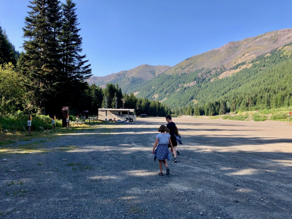
Only down side was that we couldn’t see The Mountain from where we were, but a quick and scenic chairlift ride took care of that for us.
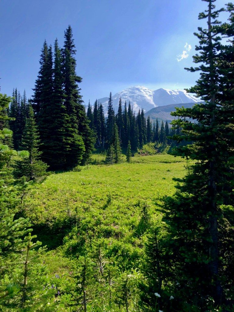
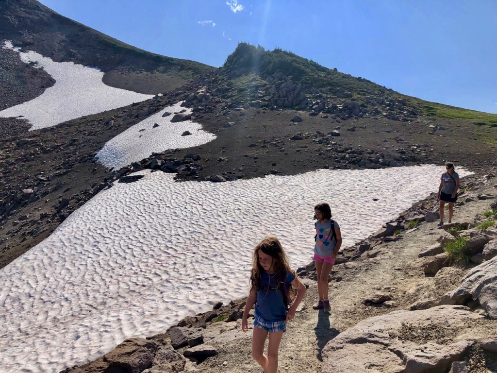
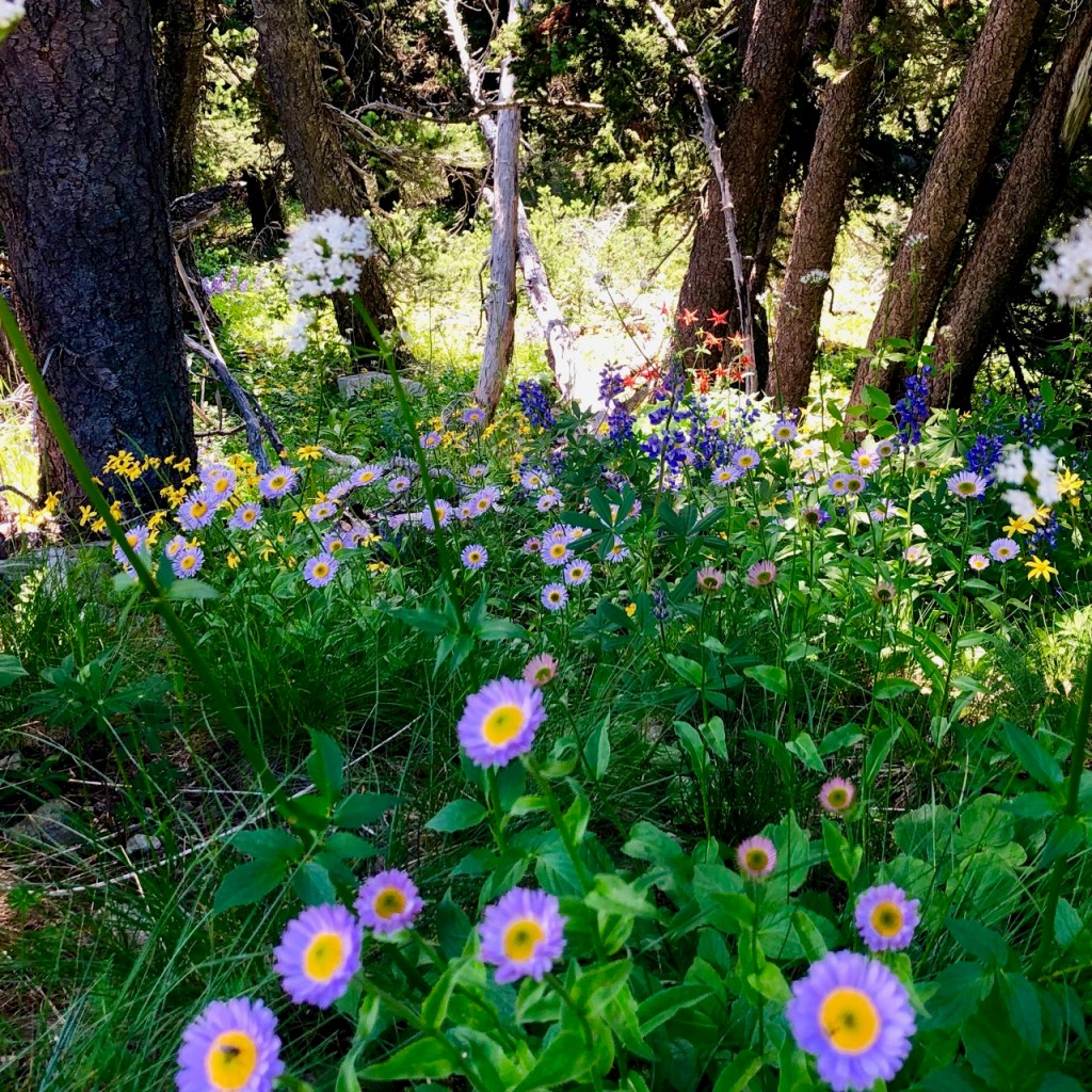
We only ended up with one full day in which to hike the park and bag the last set of Junior Ranger badges for the girls (they’re up to well over 50!), but it was a glorious one. The lake which we hiked up to wasn’t the sub-alpine jewel we were hoping for, in fact it was fenced off as it’s used as a water source for the ranger station below, but the trail itself more than made up for it.

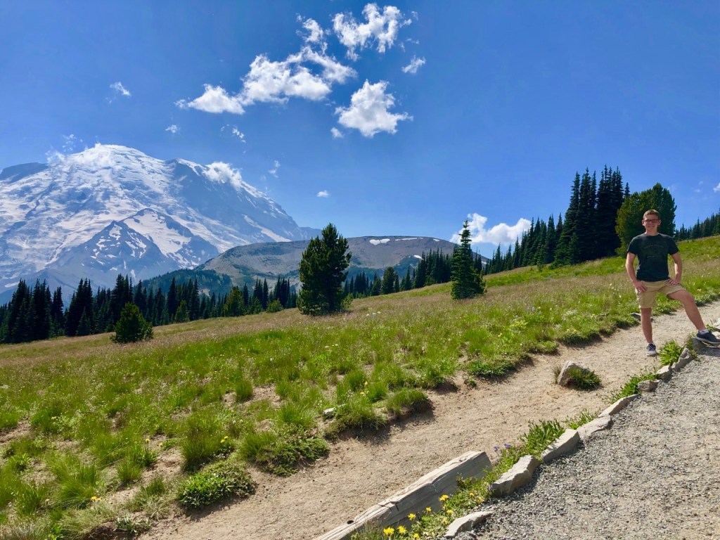
Wildflowers everywhere, jaw-dropping mountain views, and we even caught sight of a black bear playing in a nearby (but not too nearby) stream. Take that Great Smoky Mountains!

The theme of the day was mixed emotions I suppose. Bright sun, crisp air, and some of the best views we’ve seen, yet overlaid with a touch of melancholy knowing that this was our last real stop on our journey. On top of that, however, was the excitement, palpable in the kids, of knowing that we were a short week or two from moving into our new house.

In that mood, we made our second-to-last drive in Davista, from Mt. Rainier to Hood River, OR, where we’d opted to spend the night prior to pushing through to Bend. Here’s the route, which was the one presented to me when I typed the origin and destination into Google Maps on my phone.
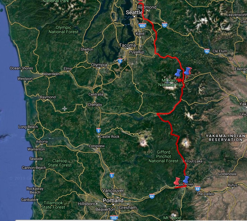
Looks pretty straightforward, right? Yeah, that was my thought too, which in itself implies that I spent time thinking about it. Which I didn’t, really. I noted that it was through the Cascades, but pictured a mostly empty, scenic two-lane road winding its way down to the Columbia River.
A quick internet search on the definition of “complacency” just now netted me “a feeling of smug or uncritical satisfaction with oneself or one’s achievements.” Ok, I’ll buy that. It’s a dragon I thought we had slain back in Carpinteria when I crunched a hole in Davista’s roof with an unfriendly tree branch. And if not then, then certainly back in the Carolinas, when we drove several hours towing a car with an engaged parking brake, narrowly avoiding fiery disaster. Or any number of the times when I took an app-encouraged “shortcut” and found myself dragging the family into peril on residential roads not remotely designed for an RV, let alone one towing a car.
But no, there we were pulling out of Rainier on our second-to-last leg, check engine light flashing away, not even self-aware enough to smugly think “I’ve got this.” More like not thinking at all. Here’s one more look, close up.

I missed a turn (more like took the wrong branch of a ‘Y’) within the first ten minutes, and found myself guiding our rig toward Yakima instead of Hood River. Perfectly good road, but in the mountains, with no way to turn around. Having lived this story before and therefore knowing how long it can take to find a place to reverse course, we opted to cut our losses, pull over into a turnout, disconnect the Toad, make a semi-hazardous multi-point turn in Davista to reverse direction, re-connect the Toad, and move on. Pain in the butt, but ultimately only about 20 minutes lost.
I should’ve paid attention. Maybe there was a reason I felt compelled to veer off toward Yakima. Hmm….
The road got narrower and more sparsely traveled the further south we pushed, and we lost cellular signal (and consequently Google Maps signal) pretty quickly. This made things somewhat alarming when we reached a completely unmarked fork in the road we weren’t expecting. Both roads looked equally plausible (and remote), and I uncomfortably stopped our beast in the middle of the road just before the ‘Y’ to evaluate.
Fortunately we had purchased a US Atlas way back at the beginning, specifically for this type of situation. UNfortunately, it didn’t show the fork.
Uh-oh. Come to think of it, it didn’t really show the road we had been on either. I mean, it sort of did, along with lots of very, very minor roads in this area, but nothing that looked like anything approaching a main thoroughfare. After several uncomfortable minutes sitting and thinking, a Jeep fortuitously ambled down the road in the other direction, its inhabitants regarding us quizzically as they passed. I waved my hands out the window as I watched them continue, and was relieved to see their brake lights and white back-up lights illuminate. We asked which way to Hood River and they told us which fork to take, but something in their tone and the way they paused and looked at each other when I asked didn’t give me a warm fuzzy. I thanked them, we pressed on, and I imagined the conversation they were having right about now.
Within a couple miles we were treated to the disturbing sight of a “one lane road ahead” sign. You’ve got to be kidding.
It wasn’t kidding.
Further we pressed, past another unmarked fork, which, without much choice, I navigated via a mental coin flip. And then the pavement ended. Yes, dirt road. Single lane dirt road. Could this possibly be right? At this point we were so deep in (and really couldn’t turn around anyway) that I reasoned we had no choice but to see this through. At least we were in a motorhome with water, food, a generator, etc. It could be worse.
It was – another fork. Resigned, I chose again. Tacco offered up that at least this dirt road wasn’t washboarded like the one in Montana that rattled the fillings out of our teeth. “No! Why did you say that – we’re hosed now.” I discovered I was correct as I began to see, more to the point feel, the washboard bumps in the road.
Soon we were on a one-lane, unmarked, washboarded, dirt road in the mountains, unable to go more than about 5 mph, with peekaboo views of an active volcano to our left. And a flashing check engine light. And Sasquatch – wasn’t this Bigfoot country?
Other than the incessant pounding and rattling, it got very quiet in Davista as we gutted onward, and in between frantic gaming out of how to handle the possibility of getting stuck or breaking down here in the middle of nowhere, so close to our destination, and avoiding the bigger holes in the road without pitching us over the edge, I considered how morbidly perfect it was to make it all this way before having our Big Crisis.
Well, mercifully, after about an hour or two we hit some pavement. Then more dirt, then pavement again, and thank the Lord, a road sign. We were going the right way!
At long last we cruised into White Salmon, WA, and across the narrow bridge over the Columbia to Hood River. Relief. And a well-deserved beer at the pFriem brewery in town after showers for everyone and a general calming of the nerves. It turns out complacency serves you no better on day seven-hundred-something than it does on day one or two or twenty. I fell asleep that night somewhat fitfully due to a combination of the parade of trains honking their way down the riverside tracks right behind our campsite and the understanding of the bullet we’d dodged today. One leg to go now, though, the ultimate.
