Short Final on the Deschutes

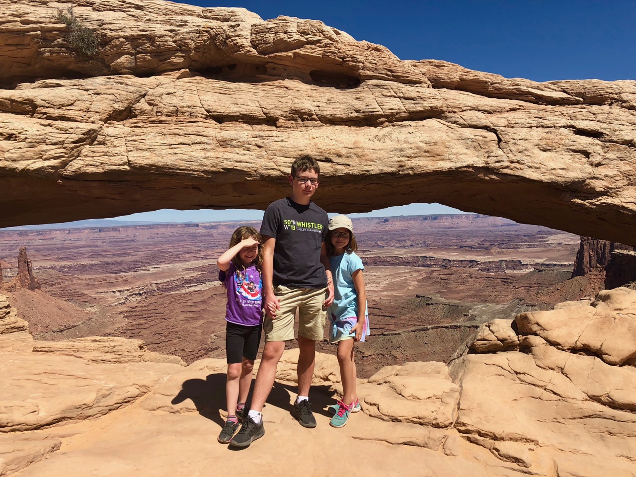
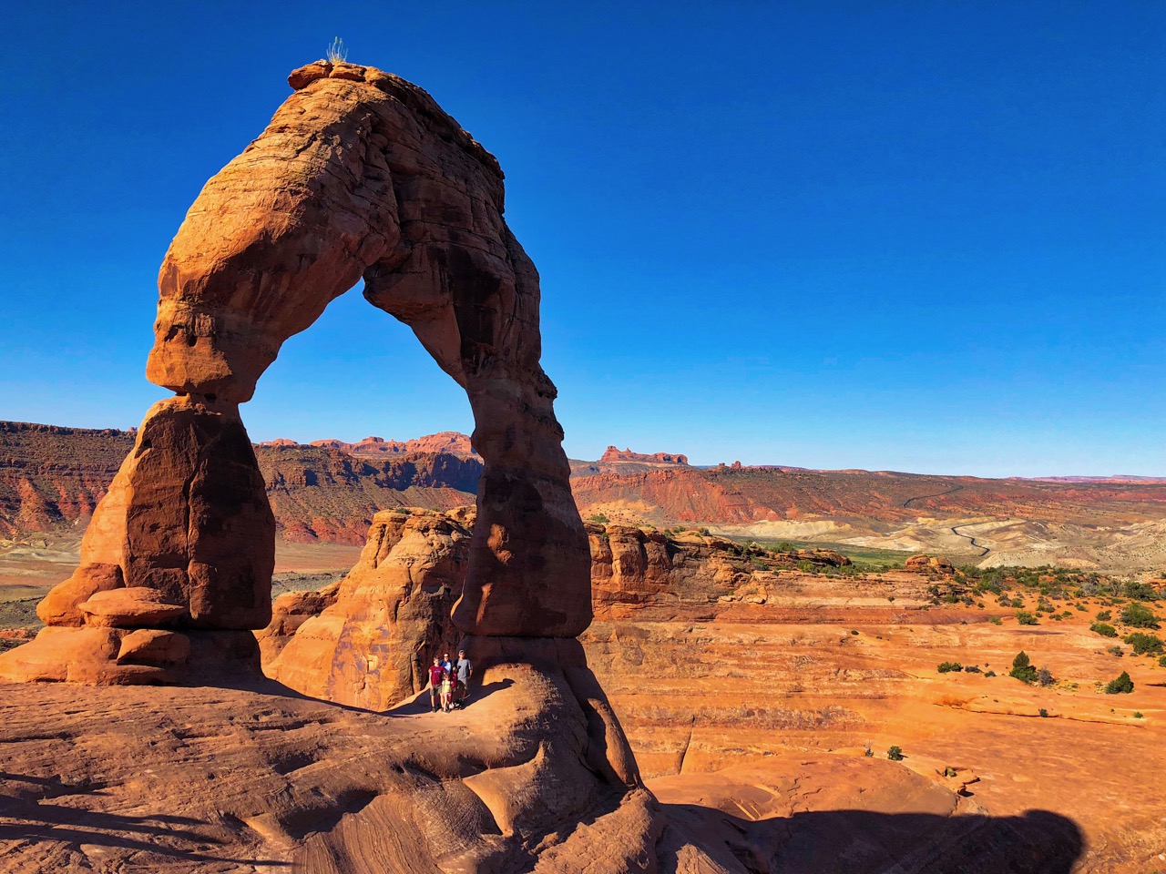
“Short Final” is aviation-speak for the very last phase of a flight, by the way. I probably didn’t need to say that, but have never been one to under-explain.

Back to Bend, and it feels like home.  I keep waiting for the bomb to drop, where we discover some seedy underside to the picture perfect downtown or the dirty secret that its ostensibly happy residents have been coerced to hide.  But no, our fourth visit in the third season (we’ve yet to get there in Spring) was, if it’s possible, even more pleasant than the other three.  If Bend has a dirty secret, it’s its not-secret-at-all isolation.  It’s a tough place to get to, and there’s really no getting around that.  I suppose the presence of active volcanoes just upwind of town might qualify as well, but that’s a dice roll it shares with most of the Pacific Northwest, so I’m willing to live with that.  Most places are a massive natural disaster away from total ruin when you look hard enough.

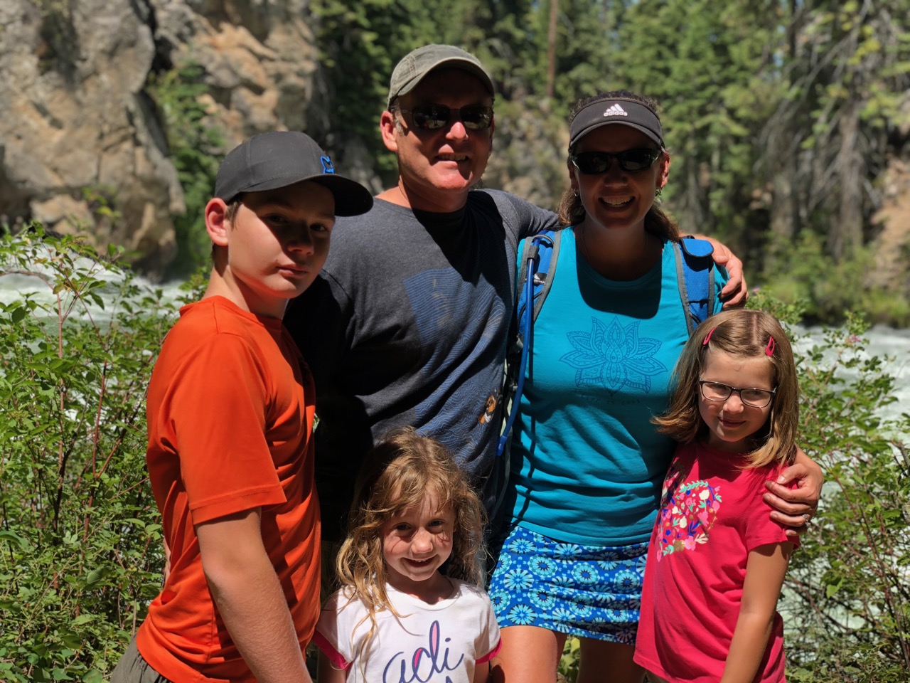
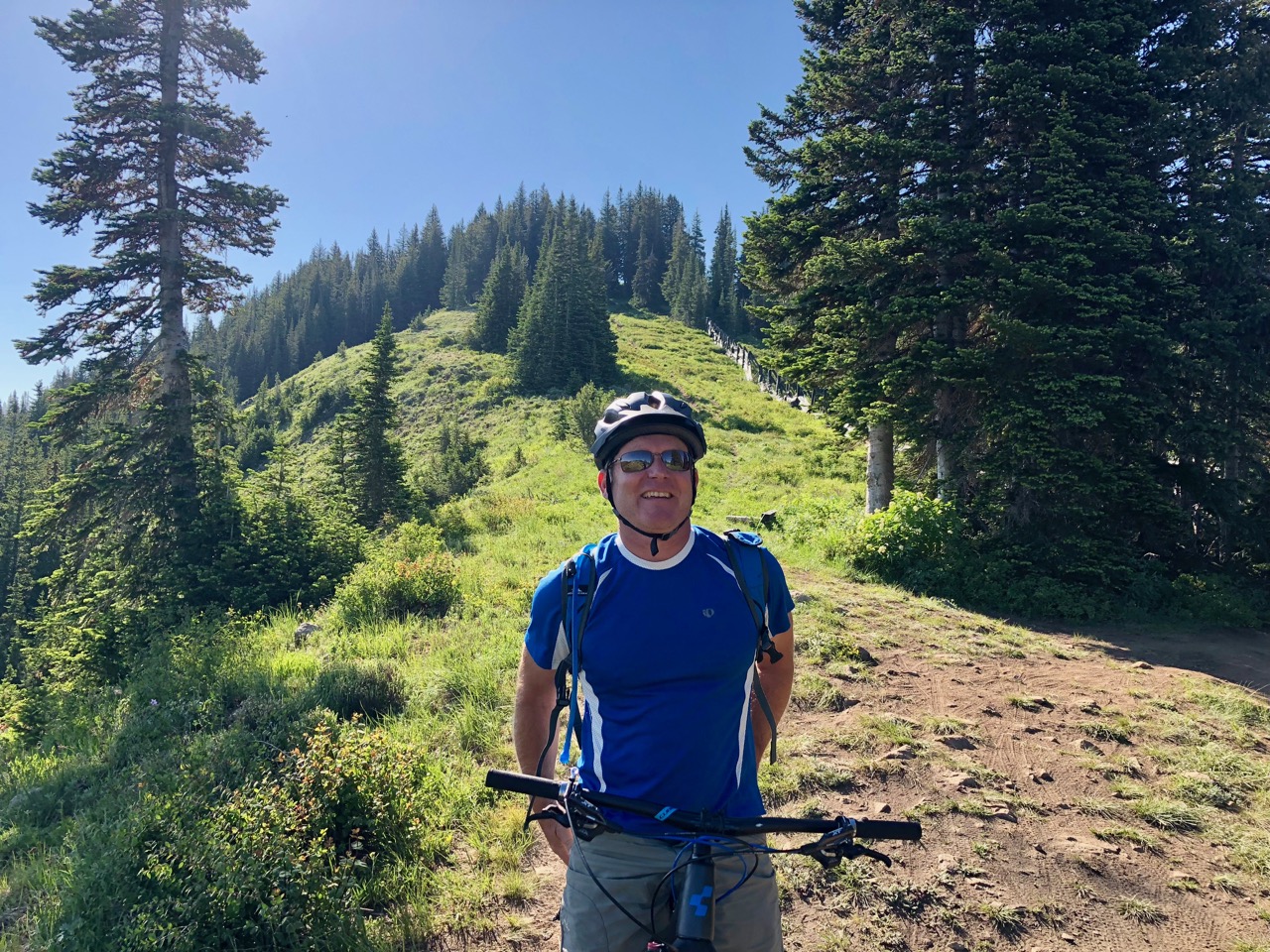
The aforementioned Check Engine light intermittently flashed itself all the way into town, but after Davista got us to Bend safely we opted to forget about it while we played.  Not only did we have a river to float and some hiking and biking to do, but we had rented a house for a few days and invited my parents up (unbeknownst to the kids) to celebrate Firebolt’s 9th birthday with us.

Opting not to break with tradition, we headed out on night one to Crux Fermentation Project’s al fresco playing field / dining area.  Despite some parking issues they’re battling through and what appears to be a significant renovation / expansion in progress, the place was packed as usual, and we set up our picnic blanket, ordered some beer and food, and dug in. 

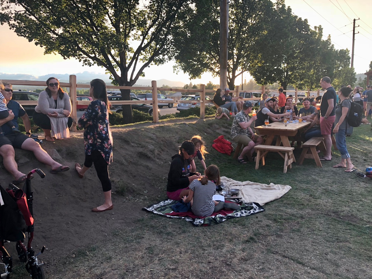
As Keeper joined in to the impromptu soccer game that some of the kids had gotten going and the girls bobbed and weaved around the field like they tend to do, Tacco and I once again looked at each other and agreed that this does not suck, not one bit.

I managed my first flying commute out of the local airport (Redmond) to Boston in order to fly a two-day trip, and though it took quite some time, it wasn’t bad at all.  The Redmond airport is tiny and impossibly easy and relaxed, at least in good weather.  I connected to Boston via Denver on the way out and Seattle on the way back.  Took the majority of the day both directions, but no hitches.  Noted.  Though my intention, should we live there, would be to fly trips out of Los Angeles / Long Beach rather than the East Coast, it’s helpful to know that a commute across the country is at least doable, if not preferable.

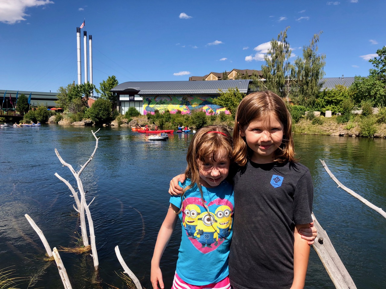
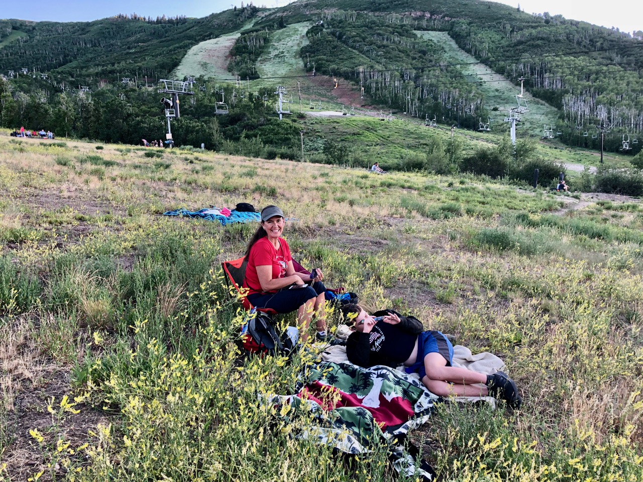
Upon my return, my parents and I converged on Tacco and the kids playing at one of the riverfront parks just about simultaneously, and Firebolt’s expression once she realized that her birthday celebration just got larger and more joyful was priceless.

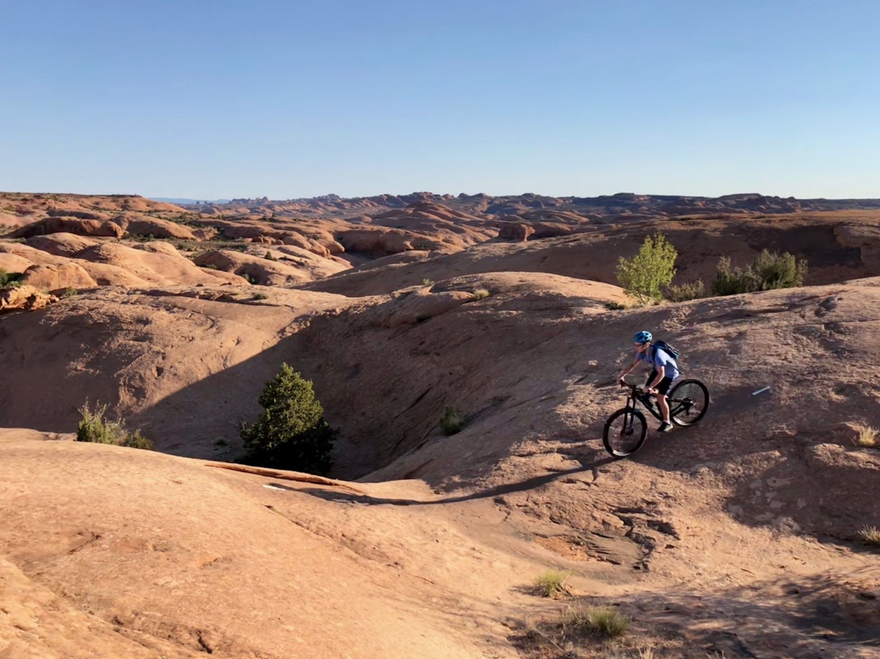
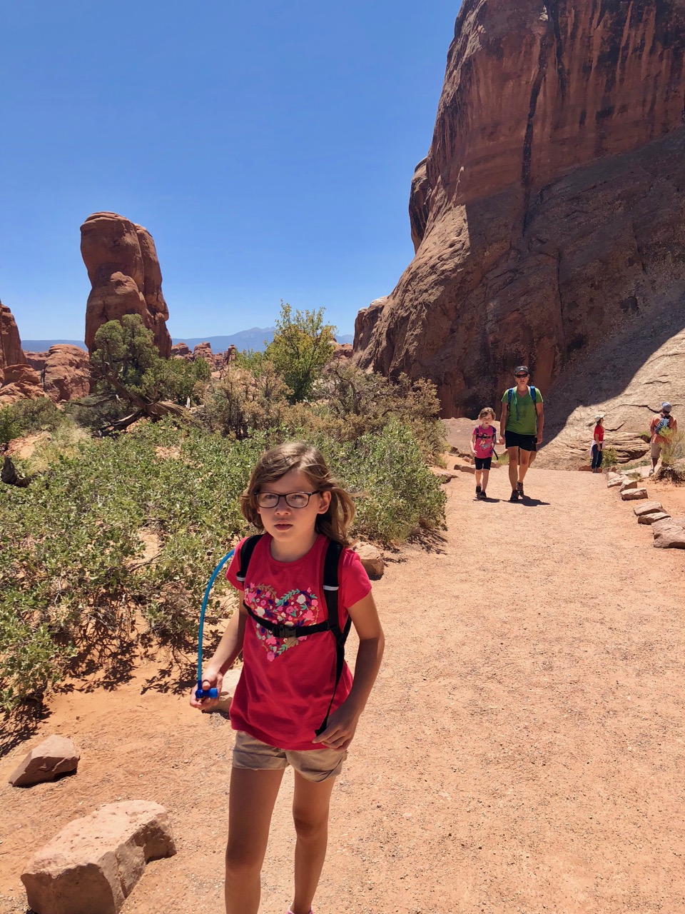
As the weather was perfect and most of us had been cooped up and sitting for most of the day, we took a short hike along the river, letting the kids show their Grammy and Papa what cool things they’d discovered about our possible soon-to-be hometown, including the white water park, the riverfront “casting course,” and the panoply of river floaters on tubes, paddle boards, and inflatable flamingos, meandering through the scenic Old Mill district.

Resolving to float the river ourselves the next day, we headed back to our rental house to settle in.   Ideal, as expected.  Quiet neighborhood near the river, criss-crossed by walking and biking paths, and infused with the scent of the plentiful ponderosa pines.  A few deer strolled by as if on cue, and at one point we spotted a large owl silently eyeing us from just under the roof on the next house over.

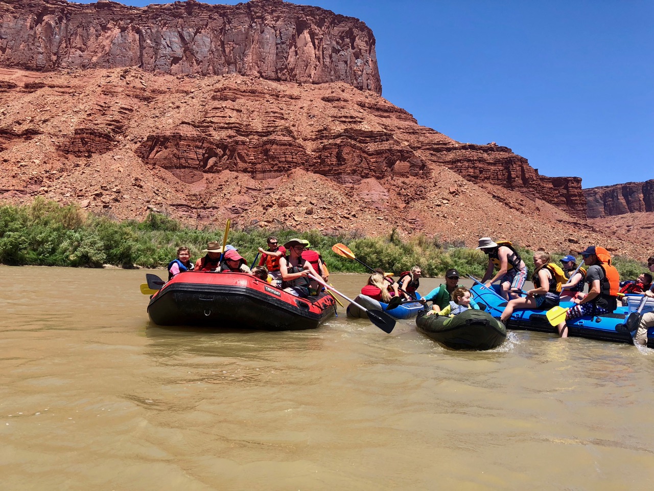
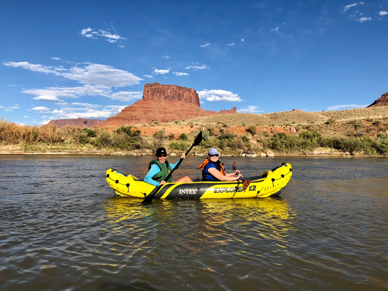
Though we had floated the Deschutes last Fall, that was several miles upstream, in Sunriver, and a much more serene undertaking given the location and time of year.  In downtown Bend during the Summer, it’s pretty much a party on the water every day.  There’s a shuttle that runs floaters and their tubes / inflatables between the put-in and the take-out, and we took advantage of it, as well as the tube rental company that operates at the shuttle stop.

Most of the float is gentle, and people tend to attach tubes into mini flotillas as they meander through town.  There’s lots of jumping into the clear water and swimming from tube raft to tube raft as well.

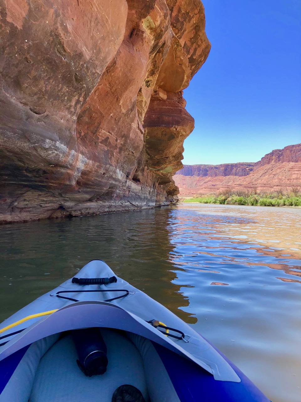
The whitewater park sits at about the midway point through town, and is a relatively new feature, replacing a semi-inconvenient portage under a bridge.  The river is divided into three sections there – a “natural” section down which floating is prohibited, a “serious” rapid section on which there are four sizable standing waves on which kayakers (and even surfers, I noted) can play & practice moves, and then the main tubing section, on which they’ve made about 10 smaller drops over which everyone can float.

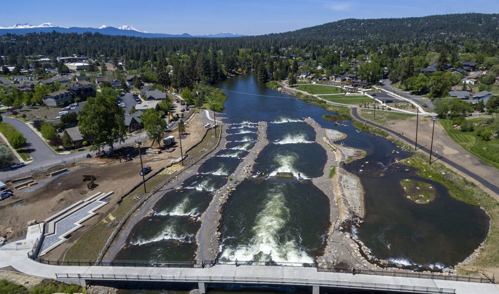
The smaller rapids are fairly gentle, but they’re still rapids, as the tube rental folks were careful to emphasize.  They suggested beginners might benefit from taking out at the portage and watching how folks on tubes navigated them prior to doing it ourselves.  Sound advice, which we promptly ignored.  For my part, I was surprised to discover how easy it is to flip over in a tube.  The natural tendency, when seeing a breaking wave looming in front of you, is to lean back, bringing the front of your tube up a bit to meet the wave and hopefully get over it.  This is actually the exact opposite of what you should do, which is to lean forward into the wave to keep your momentum moving with the current and prevent sliding back into the trough of the wave, where the current wants to push your low/back side down and forward, and the breaking wave wants to push your front/high side up and back. 

I traversed the section the first time connected to Woodsprite and her tube, completely unaware that flipping would be a possibility, and full of assurances to her that while we would most certainly get wet (welcome in the 90 degree sun), her nervousness about flipping over was completely unfounded.

Well.  Very fortunately for me, my credibility with her wasn’t destroyed for life, as we did emerge unscathed and laughing.  But I’m glad she didn’t look over at me while cresting the last wave, on which I went wide-eyed when we came a hair’s width from going inverted. 

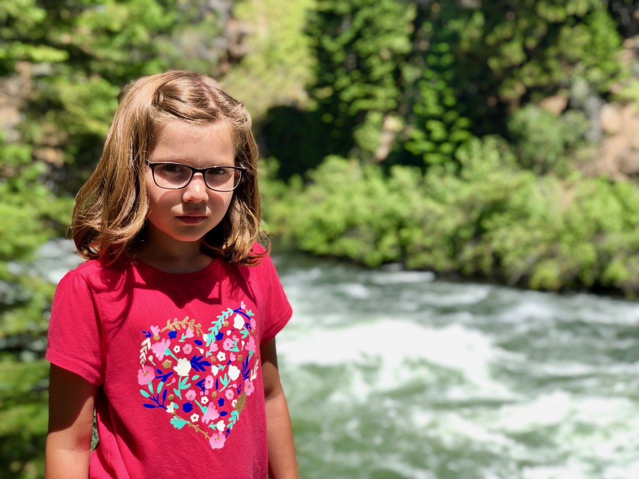
Firebolt, on the other hand, was another matter.  Though her horizons have expanded immeasurably on this trip, she still possesses an innate skittishness beyond that of her siblings.  Certain things frighten her, and when she gets it into her head that she doesn’t want to do something, she doesn’t budge.  The rapids were borderline for her, and required some cajoling.  Her initial plan was to take her tube out and walk through the portage while we had our fun.  We were, however, able to talk her into navigating them attached to one of the adults, which she did, and enjoyed immensely.  Victory!  Until the next float.  We actually floated the river one more time after the grandparents had left, having enjoyed it so much the first time, and Firebolt, flush with confidence, opted to hit the rapids solo.  On the last rapid, the one that almost claimed my credibility with Woodsprite, she initially got stuck in the wave.  I happened to be standing nearby, having just gone through with Woodsprite again, and could see the panic beginning to register in her eyes as I waded toward her.  What happened next was a bit unclear, and transpired very quickly.  A tuber behind her either tried to help by nudging the back of her tube with his foot, or simply collided into her due to the current, and the contact was all the tube needed to flip her over backwards and put her underwater in the wave with the tube on top of her. 

I pulled her up almost immediately, but between the confusion, the rushing water, and the fact that she had hit her head on the rocky bottom when flipped, she was terrified and inconsolable.  Poor girl.  It was all we could do to get her back on her tube to complete the float, even though the rest of it was flat water.  She informed us that she would never tube or kayak on a rapid again, and I almost believe her – of the three kids she tends to be the most serious and resolute about this type of pronouncement.  But still, I think she’ll come around.

Mishaps notwithstanding, floating the Deschutes was a huge success, and planted even more let’s-live-here seeds in all of us, as if we needed them.

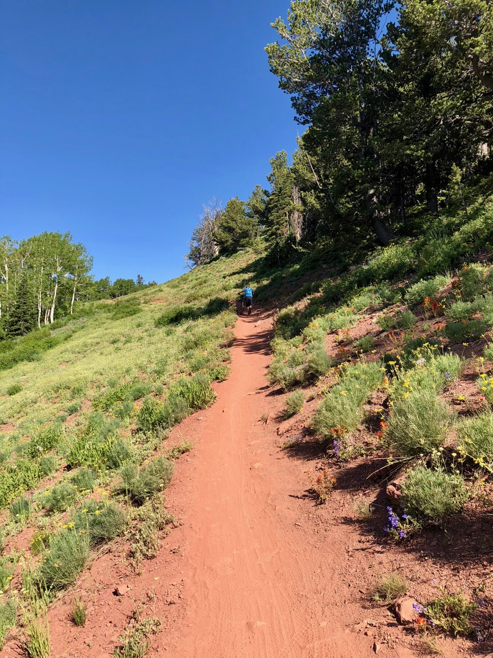
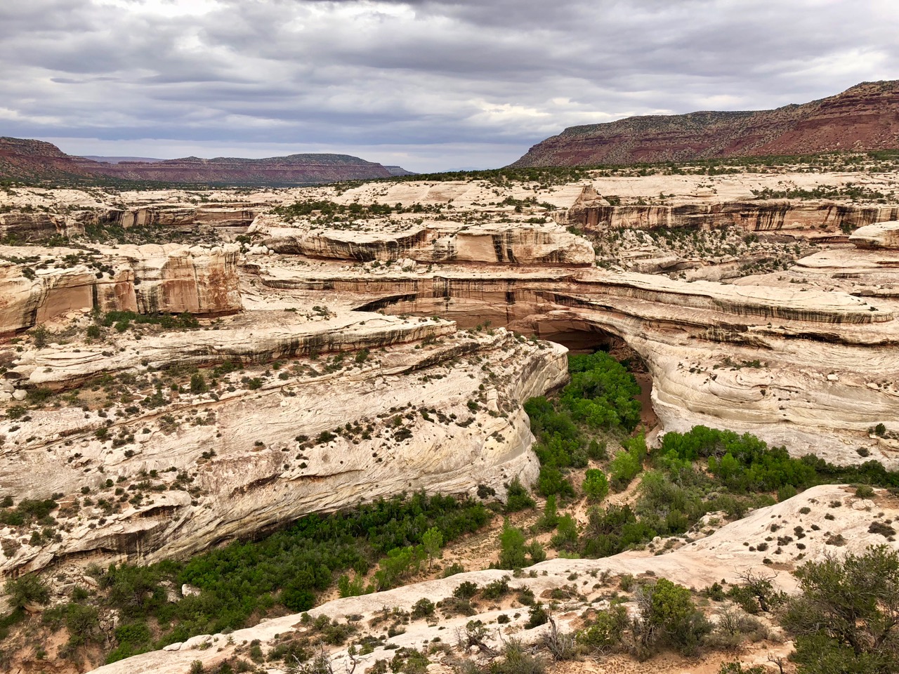
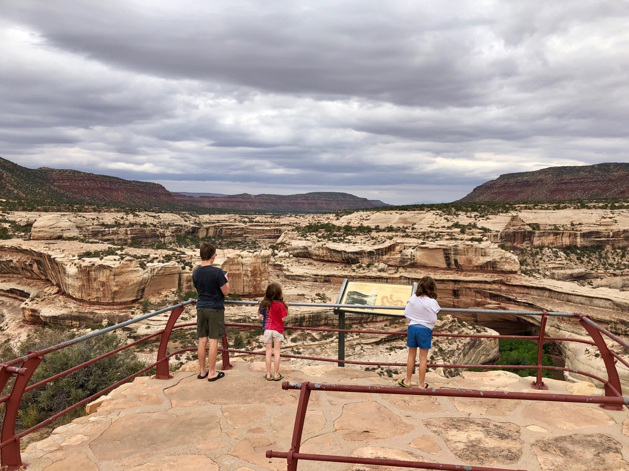
One of Firebolt’s birthday requests was a hike (!), so we of course obliged her with another walk to Benham Falls, this time with my parents along.  It’s so easy and appealing to imagine doing this on a whim in the future, particularly when confronted by a casual “I’m bored” from one of the kids.

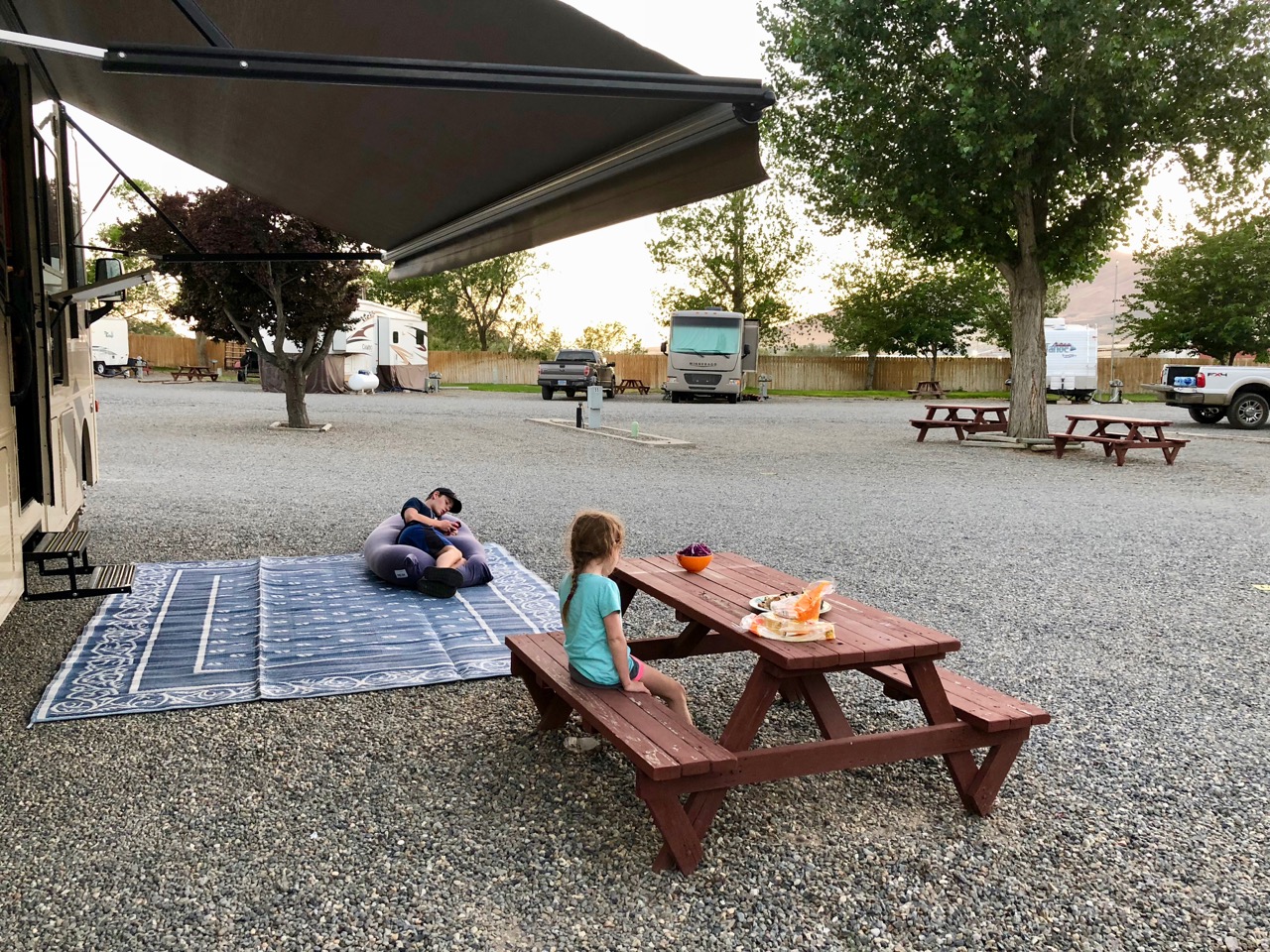
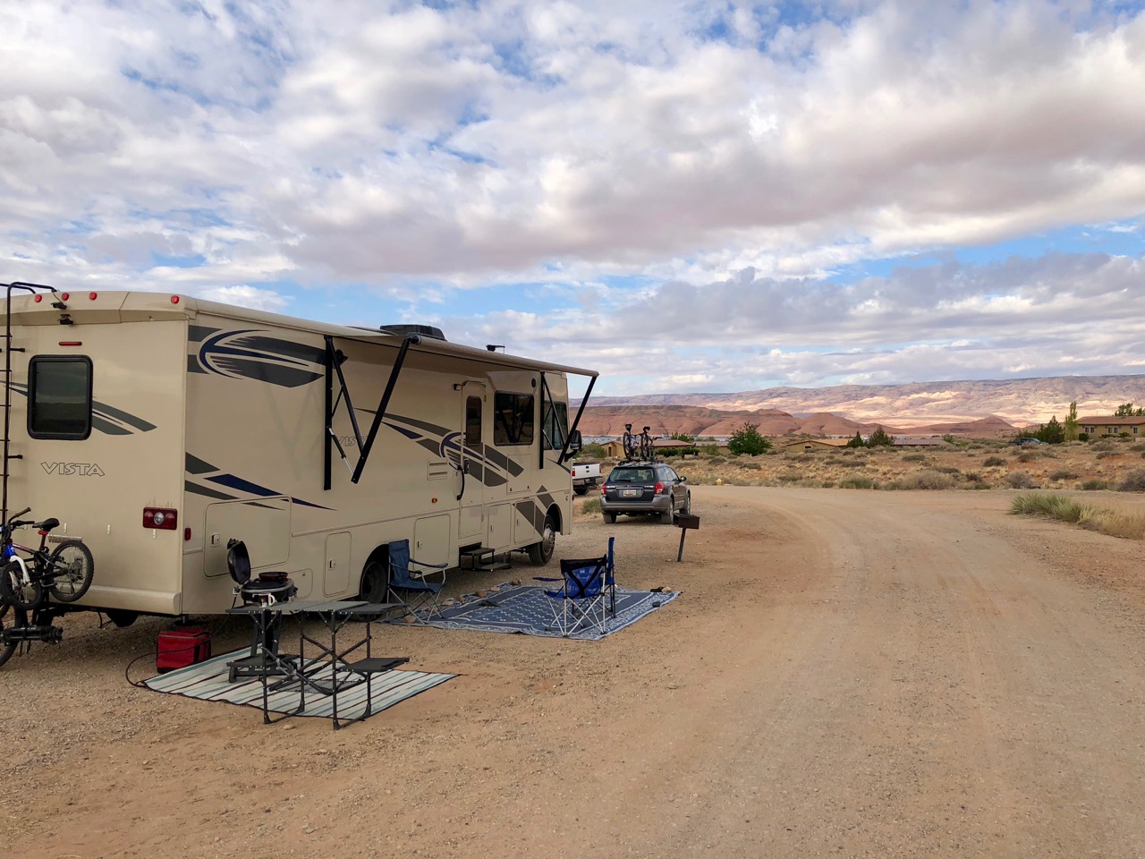
After my parents left and the celebrating ended, we relocated to the RV park in Sunriver where we had stayed the previous year.  We found it to be much busier and more “resort-y” in the summer, but also discovered that we definitely prefer Bend to Sunriver.  Nice to know it’s nearby, but there will be no temptation to look at Sunriver houses during the home shopping phase, should it come to that.

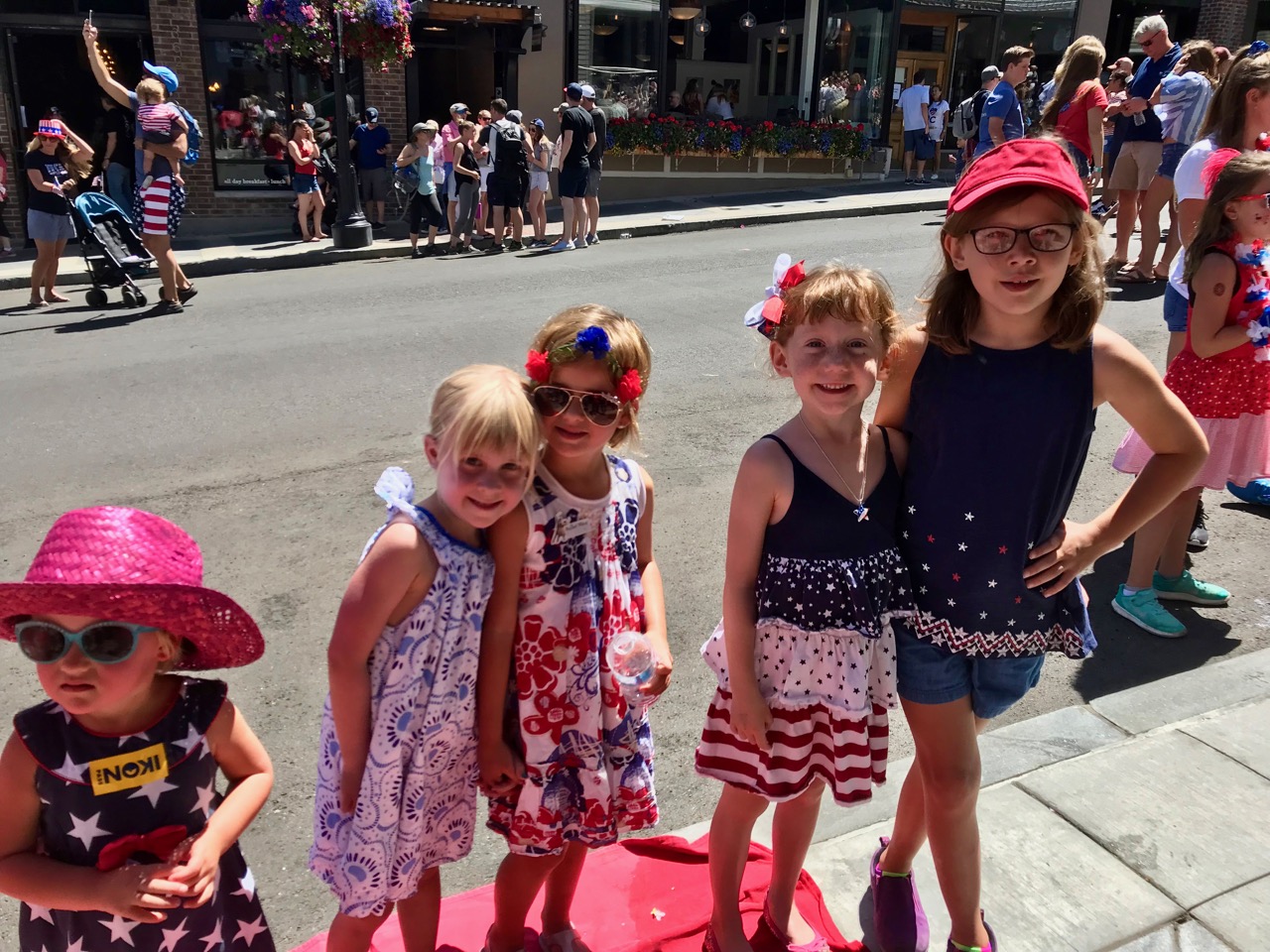
Overall, Bend hit it out of the park once again.  We spent a decent amount of time exploring neighborhoods when we could, and again managed to have our expectations exceeded.  Everything looks well-planned and thoughtfully appointed there; there were no ugly neighborhoods, only pleasant and frequent surprises.  “Look at that, another insanely well-appointed local market!  A cidery!  A charging station in the middle of the park!  Sculptures in the middle of the traffic circles!  More bike paths!”  and on and on…  We didn’t have a chance to look at any houses, but do feel like we’re homing in on a few neighborhoods on which to focus, should we move.  And the kids are even more enthusiastic about it than they were after our Winter visit. 

We’re still not 100% there, and of course we technically still haven’t sold our house, though our intention is to fly back to Annapolis in a few days in order to complete our pack out / storage and finish whatever else needs done (which is quite a bit, it turns out) prior to the closing. 

It’s a strange feeling, to have everything seeming to come together, yet still feel a universe away from settling down, despite its being our goal.  We’ve drifted in and out of a similar phenomenon over the past year, where whatever groove we’re in begins to feel familiar and “normal” and then we’re abruptly jolted back out of our comfort zone when confronted with some combination of the reality of what we’re doing and a change in our situation.  It’s difficult to describe, though I would imagine similar to what one would think (and what we thought) when considering the idea of doing what we’re doing now.  It seemed utterly overwhelming.  Extremely cool, but ultimately impossible.   Well, stopping what we’re doing and actually living somewhere now seems the same way.  It’s like we’re completely aware that it’s possible and could tell you how to do it, but the actual getting from here to there seems insurmountable and on some level terrifying.

And on that note, we leave Bend again.   

Gremlins in the Hinterland


This thing.

Argh!

I’ll say it, Check Engine lights suck.  They do.  Your brakes go, you replace your brakes. Cracked windshield? Repair it. But Check Engine? Vague cause, even vaguer potential fix, and can lead to the worst sort of bloviating when seeking opinions on them. 

Once again I’m getting ahead of myself though, let me back up.

We drove down the mountain out of Park City and into western Utah’s desert, which is as desolate and unappealing as the eastern half of the state is spectacular.  The last stretch of I-80’s traversal of the state, just before reaching the border town of Wendover, takes you across the Bonneville Salt Flats, of land speed record fame.  The name says it all – miles and miles of flat salt. 

I don’t want to strike the wrong tone here, though – it’s an interesting drive in its own way, through a unique part of the country. Unavoidably, though, if you start in Utah and head toward points west / northwest, you are going to find yourself in wide open, empty territory for at least a day, no matter which route you choose.  Here’s the one we chose.

Most folks, I would suspect, opt to put the pedal down and make this drive “the long one” in order to blow through Nevada, but we’re mostly over long drives.  If there’s nothing compelling us to hurry, then six hours or so is about as much as we try to do.  So we chose Winnemucca as our midpoint overnight stop.

Winnemucca was ok.  Here’s a pic, which about covers it. 

The exceedingly friendly and aggressively sunburnt campground host informed us that we had just missed his famous tri-tip, of which he had grilled several pounds for the campground’s residents on the 4th.  I was actually bummed we missed that; it sounded tasty. 

There was also a dirt racetrack at the adjacent Humboldt County Fairgrounds, at which some event was sharing its noise and bright floodlights with us.  But it wasn’t enough to keep us awake.  We crashed early and left in the morning.

One thing that was surprising about the drive was the extent to which Nevada, at least along I-80, was greener and more populated than expected, and eastern Oregon was more empty than expected.  To an extent I knew this from driving Bend-to-Boise last Fall, but this particular quadrant of Oregon I had never seen, and it is easily the most wild and empty region we’ve yet traversed.  Tacco remarked that we could be in the Scottish highlands.  Probably a bit less green and craggy though.  Regardless, it was worth seeing.

But that Check Engine light.

So if you’ve been with us here since the beginning, you may remember that this is not the first time it has reared its yellow head.  It illuminated in August 2017 while crossing Reservation land in Montana, and caused enough concern for me to pull over and do a little quick research.  After determining that it was almost certainly nothing of concern, we pressed on, only to have it extinguish a few days later. 

One of the problems with a Check Engine light is that even if the underlying condition clears, the light will stay illuminated for three “drive cycles,” which are essentially complete drives of reasonable length.  Normally, in a car, you can easily do three drive cycles in a day.  For us, we tend to drive for 4-6 hours at a time and then stop, sometimes for days.  So one Check Engine light that’s telling us about something that the computer sensed for a second, could theoretically stay on for a couple weeks. 

It becomes hard to take seriously.  Being in aviation, I’ve become hard-wired not to ignore warning lights, so this was especially difficult for me.  It would illuminate, stay on for a while, and then at some point at a gas stop or getting underway I would start up Davista and note that the light was out again.  This cycle played itself out no fewer than a dozen times over the past year, and what’s more, we’ve had three routine maintenance visits since then, and told the mechanic about it each time, but were assured that it’s nothing.  “Probably just a loose gas cap.” 

Well.  Somewhere between Wendover and Winnemucca it started flashing for about 30 seconds, which is where stuff got real.  Having never seen it flash before, I pulled over to investigate, and discovered that a flashing Check Engine light, unlike a steady one, means one thing only, and that’s an “active misfire” situation.  In other words, one or several cylinders are misfiring, right now.  The operating manual’s guidance in such a situation is to take it in ASAP for service, but if that’s not possible, to “drive moderately” until it is possible.  And to look out for excessive temperatures under the floorboards, as the catalytic converter, among other things, may dangerously overheat.  Not what you want to hear in the middle of Nevada.

Here’s what was strange though, it didn’t feel like it was missing.  I’d like to think I know what a missing engine feels / sounds like, and I noticed nothing.  Hm.

The next time it started flashing, I looked down at it and got distracted enough between looking at the light and feeling/listening for misfires, that I remained in the right lane and blew by one of Nevada’s finest as he was finishing up writing someone a ticket on the shoulder.  Seeing his angry / flabbergasted hands-thrown-up-in-the-air gesture in my rear view mirror made my heart sink, and his rush to his patrol car and quick sprint to my tail with lights ablaze to pull me over confirmed my feeling.  First ticket in Davista.  Actually it’s my first moving violation in as long as I can remember – at least 20 years.  Good times.

The Check Engine light continued to flash intermittently, without apparent rhyme or reason and for durations varying from 5 seconds to about a minute, for the rest of the drive to Bend.  It was extremely disconcerting. 

At some point post-Winnemucca I decided that it was time to buy an OBD2 Scanner so that I could plug into Davista’s computer brain and see for myself what was going on with the light. We stopped at the next population center to do so.  If you’re thinking that this is something I should’ve bought prior to the trip, then I wholeheartedly agree.  But sometimes you don’t know what you don’t know.

The scanner informed me that our engine’s #2, 4, 6, and 8 cylinders were misfiring.  Frequently.  Well, shoot.

The troubleshooting side of me that had spent hours, by necessity, attempting to solve airborne maintenance puzzles in the 1960s-vintage P-3 back in my Navy days kicked into high gear and immediately told me that something wasn’t right – that four separate cylinders don’t fail randomly and simultaneously, and that this data coupled with my not feeling anything resembling a misfire pretty much screamed that we had a sensing problem, not a misfiring problem.  But the pragmatic side of me kicked in, too, and told me that not only do I not know squat about truck engines, but that this particular truck engine was under warranty, and therefore the fix was essentially out of my hands. 

We pulled into Bend with the check engine light still on, having flashed dozens of times between Winnemucca and our destination.  Each time I wondered whether this was the time that would culminate in a loud bang and thick black smoke pouring out of our dead engine. 

Fortunately it never came to that, but I was a frazzled upon our arrival.  The plan is to forget about it for now, and enjoy Bend, yet again, while celebrating Firebolt’s 9th birthday.  We’ve rented a house for her birthday weekend and have a surprise visit from my parents on tap.  Gremlins can wait.

Progress!

We have an offer on the house.

We have an offer on the house!!  

This has been such a torturous road.  Not the one we just drove back to Park City from Moab, that one was nice in a rocky desert sort of way.  The home selling road I mean.  I could not flip houses for a living or a hobby.  Perhaps repetition and lack of attachment would make the process more palatable, but still…no.  I don’t stress out easily, but something about the combination of dealing with such a high-priced asset, having its valuation seem so arbitrary, getting occasionally harsh feedback on it from potential buyers (and real estate agents), and on top of all that having such a personal connection to the thing you’re selling…  Like most people, I’ve heard both the aphorism “it’s just business” and the less common but to me more resonant “it’s never ‘just business.’”  Try as I might, I’ve not been able to detach from the process and accept that housing markets, like most markets, are both efficient and impersonal.  So this past 15 months have taken a toll.

For some time now, to anyone who would listen, I’ve launched into multiple extended rants about the “comps” in our mini-subdivision, the frustration of being on what feels like an ice-cold islet surrounded by a sea of supposedly red hot housing market, and various other things that are equally beyond my control.  Through her frustration, Tacco has heard me out patiently and lovingly each time, even when the rants weren’t directed her way.   So I’ll refrain from launching another into the ether here.  Instead I’ll just say that it’s a massive relief to have an offer that looks legitimate and promising, even if not lucrative.  No endless chains of contingencies, no ongoing criminal record for the potential buyer – in fact they (the buyers) look a lot like we did a few years ago, in that they’re a Navy couple moving to the area with young kids, about to start a stint teaching at the Naval Academy.  Not breathing easy just yet, but this looks promising!

Park City, though… we’re back to Park City.  Though a stroke of luck (and possibly a computer glitch) I was able to reserve a full hookup campsite for ten nights at Jordanelle State Park, including the 4th of July.  As we learned after receiving an automated vacancy notification from the website and quickly making the reservation, this particular campsite is normally blocked off for campground volunteer workers.  Not sure why it popped temporarily onto the open market, but after calling and asking about it, the State Park informed me that it was indeed a mistake, but they would honor it.  Sweet!

Despite our strong draw toward Bend, Park City is still very much on the final list of potential future homesteads, and like Bend, it’s a fantastic place to spend the 4th of July.  Along with the continued town auditioning, our plan was to relax for a while after the frenetic activity in Moab, visit some friends and family, check out the parade down Main Street on the 4th, and watch fireworks from the dry slopes near the resort’s base.  

I also had a five-day work trip to fly, and had set up an appointment with a local “back guy” (sports chiropractor, in this case, but with a unique treatment modality that a local friend of mine swears by).  Though my sciatica has finally shown signs of easing, likely spurred by Tacco and her friend’s aggressive acupuncture treatment in Albuquerque, it’s far from gone, and I really need to stop hurting.  I’m hopeful.

Jordanelle is just a bit outside of town, as I’ve previously described, but it sports a large reservoir on which there’s tubing/skiing/wakeboarding, as well as decent fishing.  There’s also a view of Deer Valley’s ski slopes, whose widespread groves of aspens turn vibrantly yellow and red in the Fall.  Relaxing comes easy there, and the cool evenings brought on by the 7,000’ elevation were a welcome change from Moab’s heat.

Before leaving on my trip, I was able to link up for a bike ride with an old friend who lives in town.  I say “bike ride,” but that definitely undersells it – his wife (another old friend) drove us and the bikes up to 9717’ Guardsman Pass, where we joined the Wasatch Crest Trail and rode the 13 miles to his house via the ski resort’s relatively jagged ridge.   Whoa. 

He had advised me to “bring some film along” as the views were non-stop and spectacular, and he was correct. 

Fortunately for me, the ride was net downhill by about 1500’, but that didn’t stop us from having to tackle several climbs, one of which, he informed me just before downshifting and grinding away, is called “Puke Hill.”  For the obvious reason.  

We finished up with some cold drinks and long-overdue catching up in he and his wife’s backyard, through which, true story, wayward moose often wander and pause to be photographed.  I was very curious to get their take on living and raising kids in Park City, and was able to get what felt like a pretty solid picture of it.  Positives: climate, recreational activities, ski slopes in your lap, athletic/outdoor orientation (I believe Park City counts more Olympians as residents than any town in the US), and well-appointed schools, due to all of the property taxes collected.  Others: Expensive housing, potential lack of water, traffic in town, and the money thing – i.e. there’s a lot of it around, and though most of the owners of the truly ludicrous 8-figure ski cabins are part time residents at best, it’s still quite a “rich” town, which can be a mixed blessing.  More on that later.

I returned to Davista exhausted in the best possible way, and couldn’t help remarking to Tacco how extraordinary it was that I had ridden Slickrock with Keeper two days ago and the Wasatch Crest with my friend today – the abundance of it was nearly overwhelming, and I tried to make a mental note to remember this feeling when discussing future lifestyle and residence choices with Tacco.

After a pleasantly uneventful work trip, I returned to the family and the next morning visited the chiropractor down in Salt Lake.  He asked an extensive set of questions and put me through various contortions in an effort to determine the source of my pain, and seemed to come to a highly confident conclusion that the source of my sciatica was muscular (glutes) rather than spinal.  This was good news, and jibed with Tacco and her friend’s sense of my issue’s source as well.  It’s no less painful, but far easier to treat.  His actual treatment is difficult to describe, but involved more (and more precise) contortions combined with sustained pressure on very specific points.  Just as he had warned me it would be, it was quite painful.  But it seemed like a good pain – a productive pain.  I left his office feeling somewhat better than when I came in, and more importantly, optimistic that I’ve turned a corner.

Our plan for the 4th was to drive into town to see the parade, then to meet up with the friends with whom we had hung out on our last visit (and in Montana), as they were throwing a mini party in a condo overlooking Main Street.  Then we would make our way to the base of Park City Mountain Resort for a bit of play time (live bands, etc) while we waited for night time and the firework show. 

Traffic, as it turns out, really is a factor in Park City.  While it’s unfair to judge it by what is arguably the busiest day of the year, the fact remains that due to geographic constraints, there are only two roads into town, one from the east and one from the north.  They gum up quickly.  Our intention was to do the smart/responsible thing and park on the outskirts of town, taking the free shuttle bus into the center.  It didn’t take long to discover that we were at least an hour too late for that to be a workable plan – given the number of people waiting for the busses, the speed at which the busses were able to get into town given the traffic, and the number of busses running, the parade would be long over before we even left the parking lot.  So back in the car we went and braved the gridlock.  Frankly we’d have been far better off riding our bikes from well outside of town, and we filed that away.  

We managed to find parking near and soon enough to enable us to reach and then briskly walk the parade route in the opposite direction of parade flow in order to see the entire parade, more or less.  It wasn’t optimal, but it was somewhat festive, and we were able to find our friends and join them for the party.  

The festival at the base of the resort was more spread out and less frenetic.  The kids were able to do some rock wall and ropes course climbing, as well as get their faces painted and meet some other kids with whom they ran around the hillside, always a welcome activity.  

Snow!

We laid out blankets on what would, in a few months, become the ski area’s shallow-sloped beginners’ area and watched as the fireworks were shot more or less right over our heads.  If there’s one thing I appreciate on the 4th, it’s a firework show that I’m right underneath.  I’ve been known to say that I want my eyeballs compressing with the explosions – watching a faraway burst followed a few seconds later by a weak “pfoof” disappoints me.  Park City’s show emphatically did not disappoint.  The kids, fortunately, shared my enthusiasm and we oohed and aahed and clapped un-selfconsciously while bundled up against the mountain air’s chill.

So how did Park City do audition-wise?  Tough to say.  There was a vibe there that was noticeably different than Bend’s, and as previously hinted at, it seemed to center on money in a vague way.  One of the things we would like our kids not to dwell on while growing up is socio-economic status.  To an extent this may be both unavoidable and representative of naivete on our part, not to mention a form of sheltering.  Still though, one thing about Bend that stood out to us, whether projected or authentic, was an emphasis on good living, by which I mean the outdoors, clean air, clean water, good food, physical exertion, natural beauty, etc etc.  Shared passion for all of the above and no pretense.  Someone later asked me about the general political bent there and my answer was that I didn’t know, but that more than anything it seemed completely beside the point in that sort of place.  Park City is similar, but seems less so due the veneer of glitz, or at least the high-elevation version thereof. 

This characterization may be completely off the mark, but Tacco and I got there independently, so I want to be careful not to ignore these impressions.  We still love it — the slopes are world class and the climate is ideal.  We have friends and family nearby, and the convenience of the nearby major airport may tip us back over the edge.

In the meantime, we’ve reached an interesting stage in our travels.  We’re almost at the one year mark, which as initially planned, was the end.  With the offer on the house, Plan Sun has gotten a huge boost, and if we do go that route, then we head to the Pacific Northwest now and we stay there.  It’s hard to imagine that.  We have become so accustomed to this life that it’s nearly as difficult to imagine stopping as it was to imagine going in the first place.  A lack of a defined end (both destination and date) contributes to the general ambiguity as well.  I’m starting to realize that planning and executing our re-entry into “normal life” will require almost as much effort as getting on the road did.

Baby steps, though.  What made doing this manageable was breaking the whole into measurable subtasks, and what we need to start thinking about now, particularly if we’re not 100% ready to choose a stopping point / home base and act accordingly, is getting back to Maryland to vacate our house for good – no small task, that.

Canyons and Icons — Rounding out Moab

Our cousins’ departure for Salt Lake left us with a couple more play days in Moab.  As we hadn’t yet seen Canyonlands (National Park), we figured we’d make that drive and hopefully get in a short hike or two. 

Canyonlands’ geography and topography are interesting – the Colorado and Green Rivers flow in from the northeast and northwest, respectively, and meet in the middle of the park, dividing it into three separate areas (four if you count the rivers themselves), none of which you can reach from the others. The Island in the Sky district is the northern third, and is the one reachable from Moab via the main road. From it you can see the other two areas, Needles in the southeast and The Maze to the southwest.  The Maze is especially remote and almost completely comprised of labyrinthine slot canyons.  To reach it, you need to first find, and then take about a 50 mile dirt road which itself can only be accessed from a remote two lane road.  Needless to say, it wasn’t on our agenda, but how cool is that?

 From what I can tell, the prime activity in Canyonlands is off-roading. There is one road that hugs one of the lower shelves of the main canyon all the way around the Island in the Sky. I had driven at least part of it once before in my ill-fated red Jeep, but had forgotten how spectacular that drive was in the interim.  Here’s a stretch of it, to give a sense of the grandeur, as well as the pucker factor.

Though our Toad is all-wheel drive, she’s also pushing 160K miles, is limping to an extent, and needs to last us as long as possible, given all the aftermarket modifications we poured into her in order to make her towable. Consequently I opted not even to broach the idea of doing any off-roading there.  Tacco’s vertigo may have played into that call as well. Maybe. 

After a brief stop at the ranger station and a short walk to the rim of the canyon, we drove south toward the Confluence, where the Colorado and Green meet to become the Colorado alone.  The kids, and Woodsprite in particular, were a bit hiked out by this point, particularly given the sustained heat, so we gave them a break and promised just a short walk or two – just enough to qualify them for their Junior Ranger badges. 

Both girls, but Firebolt especially, have consistently impressed us with their retention of the knowledge gained in the completion of their Junior Ranger booklets.  One of the tasks in Canyonlands’ version involved flora identification, and Firebolt pranced from tree to shrub to cactus, pointing out to us things like the distinctive cones on the pinyon tree (whose version of pine nuts were eaten by the area’s early residents).  She has become a treasure trove of both biome-specific factoids and parkland conservation best practices, having on multiple occasions scolded various family members (*cough* me *cough*) for minor infractions, like picking up rocks… “Imagine if every visitor did that, Dad!”  At the beginning of our trip we weren’t sure how well the Junior Ranger programs would supplement their educations, but I now think it’s been valuable, and that much of it will stick.

After making it almost as far south as we could and checking out views of the Needles district from various vantage points, we turned around and headed for the Mesa Arch trailhead.

Mesa Arch is one of Canyonlands’ most iconic views, and is unique in the fact that you hike to the top of it rather than the bottom.  When you reach it, it looks relatively small, but then you realize that you’re at the cliff’s edge (a very common occurrence in Canyonlands) and are looking through essentially just the top tenth of the arch, which is anchored several hundred feet below you.  You’re not allowed to climb onto the arch itself, and for good reason, but you can get right up to the edge.

Our Canyonlands visit complete, there was really only one other can’t miss activity in Moab.  I’ve mentioned in previous posts my desire to transfer some of my love for mountain biking onto the kids, and particularly Keeper at the moment, now that he’s old enough to start getting onto some serious trails.  While I have certainly had some success therein, up to now we really hadn’t had access, or at least easy access, to any world class trails.  Moab, however, is flush with them.  They’re far from easy, though, and it became clear to me after riding Keeper’s (my old) bike that putting him on Moab trails on that bike would turn him off to biking at best and get him seriously hurt at worst.  So I hatched a plan to rent a serious bike for him and set about attempting to get him psyched up for a ride with me. 

The logistics proved more tricky than I had anticipated due to the opening hours of the bike shops and all of our commitments while in Moab, but I had let Tacco know of my intentions before we arrived, and with her help was able to carve out time on the last morning to go ride, on a bike which we had rented the evening before.  My plan was to ride the Slickrock trail, which is one of the most iconic trails in mountain biking.  It’s a loop trail east of town, and is unique in that it’s almost entirely ridden on slickrock itself, via a path that’s designated by white arrows painted onto the rock. 

The one other time I had visited Moab, I didn’t make the opportunity to bike at all, let alone Slickrock, which, to be honest, intimidated me a bit at the time. It’s billed as an advanced trail, and at the time I had only a couple years of mountain biking under my belt, none of it especially technical.  Which brings me to the question of the wisdom of subjecting Keeper to it, on a rental bike no less.  Frankly I wasn’t sure.  He just hasn’t biked that much.  But I wasn’t about to let this opportunity pass,and told him as much.  I think my exact words to him were “I’ve been waiting over twenty years to ride this trail – I can’t tell you how excited I am to be doing it with you.”

We got his bike the night prior to the ride at the Poison Spider bike shop, which was beyond awesome.  One of their employees had helped me a few days earlier with a tire issue I was having, and spent at least a half hour fixing the problem, and then when ringing me up shocked me with a grand total of $5.  These are clearly people who are all about love of the sport and want nothing more than to get people (and themselves) onto the trails.  The rental itself wasn’t cheap, but Keeper had a high end bike – they didn’t offer anything that wasn’t –and it was worth it.  Having never ridden a full suspension bike with disc brakes, we decided that we’d be best served by doing a short practice ride up the river at sunset.  Stunning, as expected.

We awoke early the next morning to head up to the trail before the heat settled in, and were surprised to find the parking lot empty.  My initial thought was “oh jeez – it’s closed! I picked the one day where they closed the Slickrock Trail!”  But we quickly discovered the improbable fact that we were just early, and had the entire place to ourselves.  Wow. Wow! 

 Through the gate and onto the sandstone we rode, and Keeper killed it. Just killed it.  I was so thrilled to watch him make his way through the rakishly angled paths up and over and down and across the rocks, that I almost forgot how thrilled I was to be doing it myself.  Slickrock!  With my son! Just the two of us, tearing up one of the most famous trails in the world!

It was a spectacular morning.

What’s more, and better, he seemed to catch the bug.  I suspect my enthusiasm was a bit infectious and he got caught up in it, but he told me afterwards that this was a definite highlight of our replete-with-highlights trip. 

I could’ve ridden all day, but of course we had places to be, and the heat set in, and the crowds began to filter in as well.  Better to seal the experience into memory and head back, with a few more pics to make my mountain biking friends jealous. 

We returned to the RV park still breathless and exhilarated, and tried to explain to the girls how much fun we’d had.  Someday I hope to do it again with them.

For now, though, goodbye to Moab and eastern Utah adventures, and off to Park City, where we plan to take another look at Bend’s most formidable competitor, spend the 4th of July, and fly a work trip (that part’s just me).

 Everyone seems to be in a groove.  No talk in quite some time of “missing” anything or wanting anything we don’t have, and still the majority of a summer ahead of us.  It’s a great place to be.  We do still have a huge decision to make,with Plans Sun and Moon looming and scads of uncertainty staring us in the face, but for now… we’re good!      

Take Me to the River

I’ve said this before, but I’m a huge fan of rivers.  How they look, how they sound, what they do… pretty much everything.  I didn’t grow up around them (San Gabriel River — sorry, nope.  Maybe long, long ago…), nor have I ever really lived near one, but I could sit beside one or walk along one for hours and I could float on one for days.

One of the things we tried to encourage in the kids prior to the trip was to set a few life skill goals for our Wanderyear.  I declared mine early on to be surfing and river kayaking, hoping that one or both of those might sound intriguing enough to make someone else’s list.  The kids are young enough not to know what they don’t know, however, so we didn’t really get anything too concrete out of them.  Skiing became a priority after our winter Bend visit, and Boogie Boarding seems to have emerged as an undercurrent during our West Coast beach adventures last Fall and our Gulf Coast stops this Spring.  But the river “thing” appears to be mine, into which I’m attempting to drag my family.  Not kicking and screaming, mind you… they appear to have enjoyed all of our river adventures up to now, and what’s more, seem to be fully invested in the idea of moving to a town in which the central recreational activities involve the river which bisects it.  And Keeper has mused on multiple occasions that his ideal house would be on a river or lake.

Unfortunately, the type of kayaking I had been envisioning, the type involving short, hard-hulled kayaks in which you shoot rapids, crest falls, play in standing waves, right yourself once you’re inverted, etc, hasn’t materialized.  That’s OK though, as I feel pretty confident that this type of activity will be easy to engage in once if we reside in Bend.  What we’ve been able to do in its place is a series of family floats (Deschutes, Meramec, Animas…), either in our inflatable kayaks or on guided river rafting tours.

They were all leading up to this one.  Quick background: Tacco has a slew of semi-distant cousins in Utah.  And by “distant” I don’t mean with respect to relationships – we’ve spent quite a bit of time with them, particularly when we lived in Utah, and we’re quite close with some of them.  What I mean is that they’re a large group, none closer in blood relation than second cousin, and at various levels of “removed.”  But we visit with them every time we’re nearby.  Several months ago we agreed to converge on Moab in June for a big rafting trip on the Colorado.  This is something they’ve done many times before, and we were thrilled to be included in it.  The plan was to do two half-day floats and to hang out in the evenings at the condos that they had rented.

I have to admit, I wasn’t initially sure what to expect.  I knew that there were rafting companies that guide trips out of Moab, but when I looked at the satellite pics on Google Maps I didn’t see much of anything that resembled rapids.  I was concerned that the river rafting trips would be lazy floats and that our cousins were overstating things.

Nope.

I should’ve known.  If there’s one thing Utah folk do extremely well, it’s outdoor recreation.  Much like their Colorado kin, they have our country’s natural playgrounds in their backyards, and they grow up learning how to play hard and play well.

They converged, about twenty of them, ages from 6-ish to 70-ish, on two Moab condos with which they were familiar, having stayed there before.   I missed the first night’s gathering due to sciatica and a bit of fatigue, but heard from the others that it was similar to the joyful, barely contained chaos that we had seen many times at their Sunday night family dinners, with the added bonus of people crashing out on whatever horizontal surfaces they could find.

We all met the following morning at their condos, and after the normal waves of group inertia had cleared, we set out to the put-in point a few miles up the Colorado.  We were joined by these folks (loitering at the put-in, not floating with us, just to be clear), who I was assured by my cousins weren’t polygamists, despite appearances.

IMG_0191 Not sure how they knew (assuming they did), but the sum total of my expertise on such things is having watched all of Big Love.  I’m clearly not the guy to ask.

Our flotilla was impressive, consisting of two full-sized rafts, a couple duckies, and two of our three inflatable kayaks, one of which (the single) I commandeered.

IMG_0206

IMG_0194

Our cousins had theirs outfitted with waterproof Bluetooth speakers which blared upbeat classics from the last few decades.  It was actually a pretty solid playlist, which tended a bit toward hard rock and away from bubblegum pop, but with a few show tunes thrown in for good measure.  Lots of sing-a-longs and dancing on the bow (which inevitably led to falling off the bow).

IMG_0196

Our girls found that they preferred being hood ornaments to paddling, which was probably better for everyone.

IMG_0211 
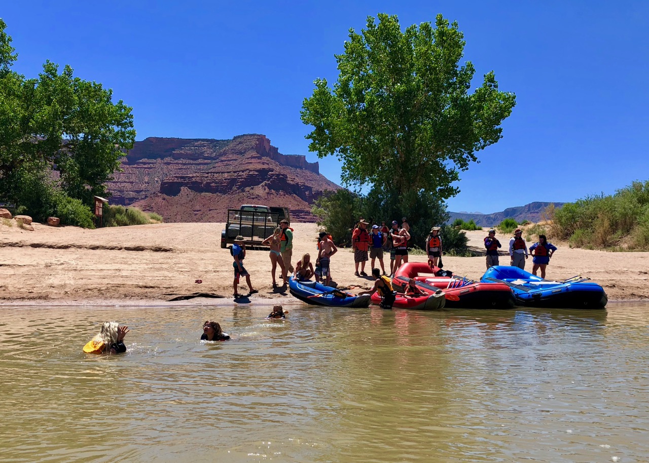
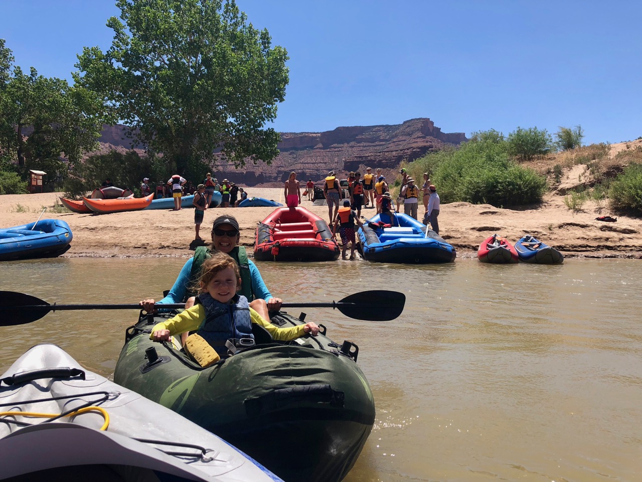
Woodsprite even swam over to my kayak and assumed the position there.  Though it’s technically a single, it can support 300 lbs or so and she’s no more than 50 soaking wet.  I was thrilled to have her there, and we even braved a few rapids that way.

At one point while sitting there she put me on the spot with: “Dad, tell me one of your stories.”  Which I loved, and obliged her with, but initially struggled.  I’m the guy who has heard thousands of jokes but if asked to tell on one demand, can’t remember any of them.  I need to up my game.

IMG_0197

The scenery was stunning as usual, and frequent dips in the water kept us all at the perfect temperature.  The supercharged water guns helped as well.  Lots of squirting.

IMG_0209

There may be better ways to spend a day, but at the moment, none are coming to mind.

Though the rapids weren’t especially tricky, they were enough to require a little bit of skill and to generate some hoots and hollers out of the crowd.  Once or twice when I decided to eddy out of a rapid in order to get back upstream and play a bit, I came about as close to capsizing as you can without doing so… unexpected at the time, but in hindsight exactly what I was going for.

IMG_0219

IMG_0217

At about the 2/3 point we pulled off to a sheer rock face where they traditionally stop to do some cliff jumping.  There’s a low ledge (about 10 feet) and a much higher one (about 30).  I was wondering whether my kids would take part.  They’re clearly beginning to flex their adventure muscles and banish some of the skittishness with which they all started this trip, but it’s difficult to know where their lines are and to what extent they’re becoming willing to push them.  Though peer pressure helps…

Imagine my surprise, then, when little Woodsprite scrambled without hesitation up onto the rocks and launched herself off and into the water.  Yes!

IMG_0198
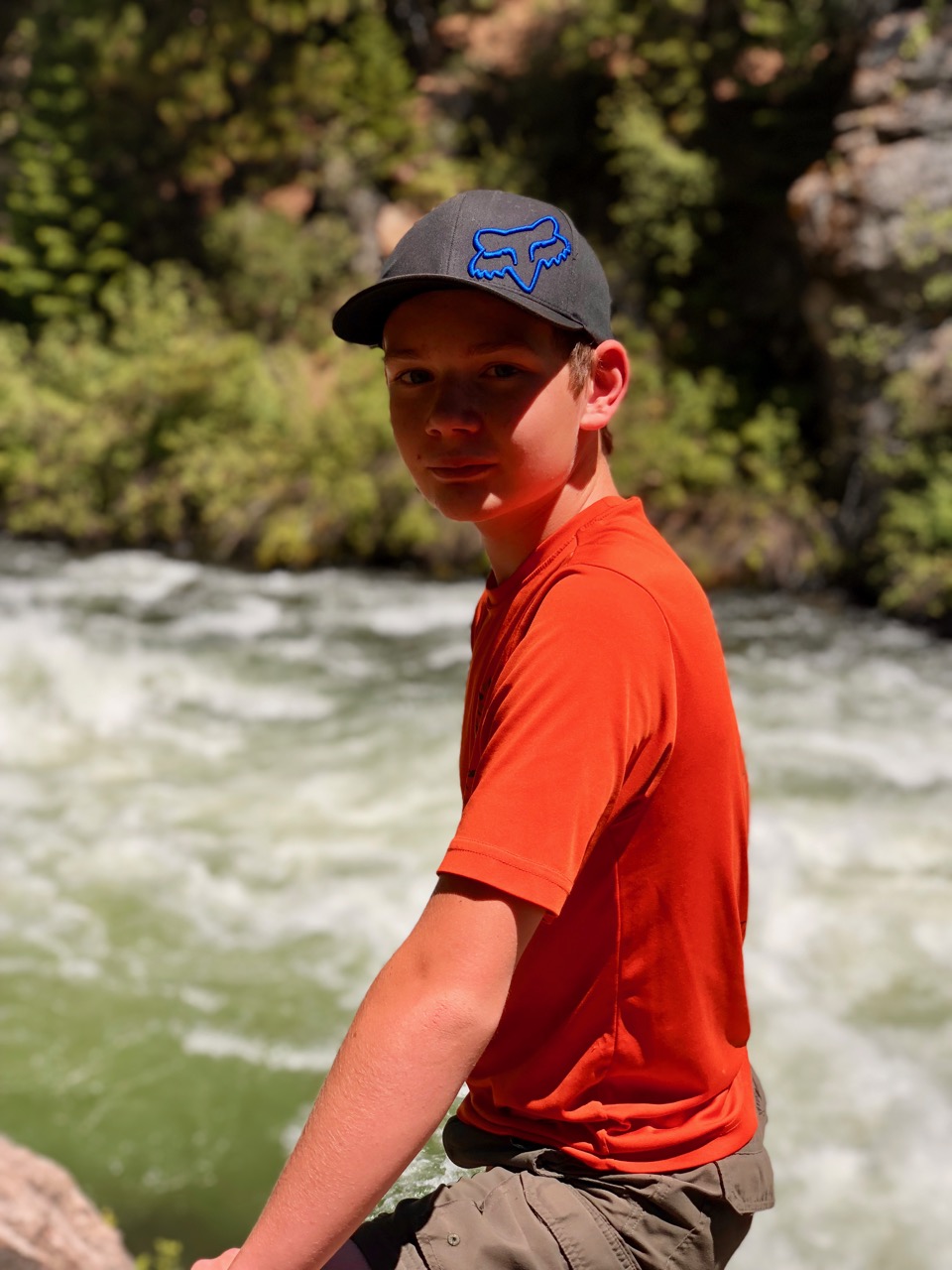
Then Keeper uppped the ante with a forward flip off the 10’ spot that made everyone gasp.  Gasp?  Why?  As I was among the gaspers, I can explain.  He didn’t jump outwards at all.  He basically tucked his head and rolled into the water, in the process clearing the rocks by inches.  He had no idea how hard-core his maneuver was.

And then!  I really need to give a shout out to my son here because he truly slayed a dragon.  Keeper has been an avowed acrophobic for quite a while now.  If you happened to read about Zion and/or Sequoia you’ll remember how difficult some of our hikes had been for him.  Well, check this out.

Frame-25-06-2018-10-09-52

He climbed up to the 30’-ish top of the cliff, and having just done that jump myself, I can attest that it was sporty.  It took him quite some time and a good bit of both encouragement from below (though frankly he was probably so far into his head that he ignored us), as well as internal mojo-summoning, but he finally took the leap.  And I think it’s safe to say that we can put his acrophobia to bed.  He’s been working on this for a while, and boom!  He grabbed his fear by the nape of the neck, smacked it around a few times, and tossed it into the abyss.  I’m really proud of him.  Can you tell?

We had pre-positioned food at our take-out, and enjoyed a great late lunch / early dinner – not great because of what we ate, but great owing to our state of mind after being on the river all day and loving the camaraderie.  Costco cold cuts taste so much better after you’ve worked for them, and everything’s better next to a river.

IMG_0203

And then… we did it again. (!!)

IMG_0230

It seemed like such a production the first day, but this was a rafting Trip, not a rafting Day, so we did the entire float again the next day, and day two was just as spectacular as day one.

IMG_0212

There was one difference, and I think/fear I may have had something to do with the changing of plans.  I had mentioned that there seemed to be several rapids further downstream that we had missed, and something to the effect of “man it would be fun…” to extend the day a bit and do those as well.  My cousin to whom I mentioned this let me know that they had indeed done that stretch of river before, and that yes, there were some significant rapids, but there were also some long, slow stretches in the interim.

After a bit of discussion, the group consensus, though that’s a tricky way to describe it, as by necessity you need a few people to just take control and handle things in a group of that size, was to take out at the previous day’s spot, but then anyone who wanted to continue would keep going while the rest returned to the condos.

I was of course among the group that opted to keep going, as was Tacco.  The kiddos headed back.  It was an interesting stretch – much more extreme on both ends.  By that I mean that the rapids were far more challenging, and a thrill in the kayak.  The scenery was better as well, as the canyon deepened in that stretch of river and the moon rose above the canyon walls while the sun headed steadily in the other direction.

But those “long, slow stretches…”  They were indeed long and slow, and an upstream wind complicated things.  The wind blew hard enough, in fact, that we could hardly get downstream – problematic when you’re doing slow-motion battle against waning daylight.  In fact, without steady paddling we floated the wrong way.  Upstream, in other words.  Alone in my kayak I had less difficulty, but still needed to paddle vigorously and steadily for a solid half-hour at a time in order to make progress.  The raft, however, had more exposure to the wind.  I had noted that they were falling farther and farther behind me as I gutted my way down toward the take-out.  What I hadn’t noticed was that they had taken Tacco and her cousin/kayak-mate into the bigger raft and tied the kayak to the raft in order to increase the number of paddles in the water, and that the mood on the raft had transitioned from sing-along show tunes and dance on the rails to Song of the Volga Boatmen, row row row.

We made it of course, but thoroughly exhausted, and just as the last light left the canyon.  As we drove back into town and re-entered cell coverage we were greeted by several concerned texts from the kids.  Fair enough, it was pushing 9PM by this time.

Me, though?  I loved it.  All of it.  We re-joined the group back at the condos for a late dinner and some sharing of war stories and bonding.  Though we joyfully hung out late into the night, Firebolt summed up how we felt like this.

IMG_0239

This is the type of family get-together I want to do… well, pretty much for the rest of my life.

Apotheosis 2 — Moab

If riding out last year’s late October heatwave from the beach cottage in Coronado was the pinnacle of our beach experience so far, then our week in Moab was the desert version thereof.

Moab is an adventurer’s paradise, and absolutely worth the long trek for anyone who is even remotely interested in what it has to offer.  I had been there once before, many years previous, but not stayed long.  The town’s growth and the influx of tourism dollars was immediately evident, but being geographically constrained and isolated by any reasonable standard, it’s neither sprawling nor pretentious in that I’m The Next Big Thing way.

A quick geographical orientation, as well as a cursory history, as I learned quite a bit from one of the park rangers in the area and found it fascinating.  Here’s the overview.

Moab zoom out

On first glance your impression might be that it’s in the absolute middle of nowhere.  And that would be correct in a sense.  As the crow flies it’s about equally distant from Denver and Salt Lake City, but several hours from both by car (about 4 and 5, respectively).  The only town in the area with a reasonable sized airport is Grand Junction, CO, about two hours to the northeast.

Moab closer

Look closer, however, and you find that it’s surrounded by National Parks – Arches just north of town and Canyonlands to the southwest.  Though Moab sits in arid high desert at just over 4000’, the relatively tiny La Sal range of mountains sits just to the east and climbs to over 12,000’, providing a green and often snowy backdrop.  The Colorado River forms Moab’s northern border, and flows through a gap between two deep canyons, leading to a flat semi-wetland extending to the south.  This turns out to be important, as not only does it allow the area to be farmed (which you see exceedingly little of in the Utah desert), but back in the early 1800s it provided for one of the only easy crossings of the river in the region – head downstream and your view to either side for hundreds of miles would be steep canyon walls, culminating in the Grand Canyon.  Hence the original settlement in Moab.  It’s a bit unclear why the name (the Moabites didn’t get especially good press in the Old Testament), but ok.

IMG_0180

Fast forward a century or so, and it becomes all about mining, with the real boom being in uranium.  Our ranger told a darkly amusing story about a local miner finding large amounts of uranium in a pile of mining waste that had accumulated on his property (“his front yard” was how he put it, but I can’t imagine there were many yards at the time) and that his children were playing in.  Oops.  Or maybe just semi-oops, because he parlayed that into a multi-million dollar mining fortune by discovering massive deposits in the area right when we as a country happened to be looking for the stuff in order to build up a nuclear arsenal in order to deter the Soviets.

We’re now in the early 1950s, and miners descend upon the area and make a fortune extracting uranium and selling it to the government.  In the process, they also cut thousands of trails and roads throughout the area, and likely bring back stories of spectacular scenery.  After the boom turned to a bust late in the Cold War, the population declined drastically, and attention turned to Moab’s potential as a tourist destination / outdoorsy wonderland.  Hundreds of thousands of mountain bikers, off-road enthusiasts, and adventure seekers are now thankful for this.  The place is booming again.

There are downsides for the residents, to be sure, but as well as the National Parks at its doorstep, Moab has a trail network that simply has to be seen to be believed.  Hiking trails, “jeeping” trails, and best of all, mountain biking trails.  Much of the riding is done on the coarse, grippy sandstone, which they ironically call “slickrock,” and several of the trails are both iconic and world class.

We arrived a day earlier than planned due to our less-than-ideal Lake Powell visit, and settled into the Portal RV park, which is an entirely decent place, but unfortunately the pool was being remodeled.  As you might imagine, it was hot.  We had been looking forward to jumping into that pool.  The folks at the check-in desk assured us that we could use the “swimming hole” on property and that “the kids just love it!”  Swimming hole though?  A small pond of what I assumed to be stagnant water sweltering in the desert sun didn’t strike me as especially swimmable, for several reasons.  So we opted to forgo that amenity, or at least not swim in it.  What I later discovered (and should have guessed, after looking at it and feeling the water) was that it was a spring-fed pond, continually replenished by the combination of evaporation and new, clean water.  The kids may have loved it after all.

IMG_0104

The heat was the only aspect of our visit that was less than ideal, as mid-90s in the desert is tricky when there’s very little escape.  Yes, we have an air conditioner in Davista, but when relative humidity hovers in single digits, the a/c doesn’t have much to work with, and we found that we couldn’t get the inside cooled below 90 during the day.  Here’s our thermometer.  Disregard that outside temp – the sensor doesn’t do well in direct sunlight – but it does give an idea of what it felt like.

IMG_0188

That’s what being warm-blooded is all about though, right?  We adapt.

Being surrounded by National Parks, there were clearly going to be plenty of hikes, so we started with Arches, and the Landscape Arch trail.  Having made the mistake of not starting early in the day (and catching a half-hour line just to get into the park) we opted to take one of the shorter walks, and hoped that there would be plenty of high rock walls casting shade.  There weren’t, other than the one below, which didn’t quite work for us, shade-wise.  IMG_0115

IMG_0118

The kids did well, though (after the standard pre-hike grumbling), and we were able to snap a few excellent family shots, courtesy of fellow hikers.

IMG_0121

IMG_0120

IMG_0129

There were a few more arches reachable via a longer stroll along the trail, but the combination of mid-day heat and soft sand to walk through led us to cry uncle for the day.  We didn’t want to sap the kids’ hiking mojo on our first area hike.

The following day we got up early, or at least reasonably so, in order to get to Delicate Arch by mid-morning.  Upon our arrival at the trailhead we were surprised to see a few folks coming back to their cars, post walk.  They had evidently caught the sunrise there, which made me a little envious.

You can hike a short distance to an overlook across a valley from the arch, but a longer trail takes you up a hill and right to its base.  There was quite a bit of exposed slickrock that we needed to traverse, and I’m glad we came early.

IMG_0134

The kiddos did extremely well, though Woodsprite threw out a soon-to-be-classic quote about three-fourths of the way up the hill when she stopped abruptly, whirled around to face me in a six-year-old huff, and blurted “DAD… can we please get OUT of these, these… Rocky Mountains and STOP IT WITH THESE HIKES!!!?”  Her outrage was real, and made for one of those parenting moments when you know that bursting out laughing is textbook what-not-to-do, and so manage with great effort to muster a response that’s gently encouraging.  Fortunately she recovered quickly, as she tends to do.  Scenery like this helped.

IMG_0170

IMG_0146

Firebolt, on the other hand, really seemed to come into her own on these hikes.  Her gait was strong, and she brimmed with curiosity and positive comments.  She pinged from rock outcropping to overlook to climbing opportunity, remarking all the while how the scenery was so pretty that it looked like it couldn’t be real.  Interestingly, her choice of terms was that it looked like a computer-generated 3D map rather than actual landscape.  I commented to her that only very recently have computers become powerful enough to generate images that looked more stunning or “real” than actual life, and that throughout my life that sort of comment would’ve been flipped on its head (something like “that computer image looks almost real!”).  I’m not sure she found that as fascinating as I did.  But Firebolt being Firebolt, she played along — “Cool, dad!”

There were quite a few people at the arch itself, which made for the spontaneous development of a family photo-taking system.  You didn’t want an arch photo with a bunch of random people in it, so everyone formed into sort of a line, awaiting their turn to be photographed.  While you’re in the line, you need to find a stranger who looks trustworthy enough to give your phone/camera(s) and to take this once in a lifetime picture without messing it up (we’ve been shocked/amused at how thoroughly some strangers are able to hose up a simple “hey, could you snap a picture of us?”).  Then when your turn comes up, you hand off your device, run out to the base of the arch, and smile, even though the only way to capture the whole arch and the photo subjects is to zoom out so far that you can’t see faces anyway.  Funny process.  I’m glad we went through the queue and got the pic though, even though we could’ve probably taken a picture of another family and said it was us.

IMG_0165-h

Overall, it was absolutely one of our best hikes.

IMG_0149

One of the other premier Arches NP hikes is the Fiery Furnace, which is guided and takes you through a maze of slickrock that is so convoluted that people tend to get lost there without the guide.  Having not made it to the Visitor’s Center early enough to sign up for a morning tour during our stay, we called our Arches visit complete after Delicate Arch.  The girls had their Junior Ranger Badges and we had two incredible hikes and about two hundred pictures under our belts — no need for any fiery furnaces.

Speaking of not needing furnaces, Tacco and I came up with a plan to cool off after a couple days there.  Our cousins wouldn’t be arriving with their river rafting gear until later in the week, and the Colorado isn’t particularly swimming-friendly.  And with our RV park pool non-existent, the Marriott’s pool with the waterfalls that we drove by every time we headed into or out of Arches began to look more than a little enticing.  As we’re Marriott “frequent fliers” via credit card, we had amassed quite a few points, and found that there was a vacancy.  So we took a little mini-vacation and snagged a hotel room for the night.  Those waterfalls were even cooler than they looked from the road, and we spent much of our afternoon and the next morning between in the pool, under the waterfalls, drying off poolside, and the heavily air-conditioned hotel room.  The private shower and bathroom was nice too – you tend to appreciate those once you’ve been using shared bathrooms / showers for a few months…

Here’s something else we discovered about Moab: the food.  I did not expect this.  Everywhere we ate was outstanding and unique.  Our first noteworthy meal was at a food truck called YummyTown.   Seriously.  Their website shows them in Santa Fe, but I assure you that they were in Moab, and it was possibly the best Mediterranean food I’ve ever had.  So many fresh ingredients, and so tasty.  And washed down with these fresh fruity / herby shrubs.  This would’ve been excellent on its own, but then they upped the ante again with their dessert special, which I almost didn’t try because dude… dessert for lunch?  Oh man though… it was a home-made baklava ice cream sandwich, and it was absolutely, positively the best ice cream sandwich I’ve ever had, bordering on one of the best desserts period.  Seriously, it wasn’t the heat, it really was that good – every element perfectly done, and the whole greater than the sum of its parts.

The next pleasant culinary surprise was the Atomic Grill & Lounge, right next to our RV park.  I had read some positive reviews online, but really was just expecting some burgers.  There definitely were burgers, and they appeared to be well made and tasty, but what we didn’t expect was the lamb belly quesadilla, wild boar taquitos, homemade mole, elk stew, duck bacon, whaaat?!  And we were seated on their whimsically decorated outside deck and served by the owner’s confident and charming 12 year old (maybe?) daughter.  Where ARE we?

One of the mornings we had, and lingered over, breakfast at a shady, new-agey café.  Those places tend to make the best breakfasts, I’ve found, and this one had it nailed.  And then just before we left we had pizza at a relatively new place that serves authentic Neapolitan pies, which are a fave of mine and can be tricky to find.  All this, and there were probably a dozen more places we would’ve like to try out.  Again, who knew?

The rest of our Moab stay deserves its own post, probably two, as river rafting with family was its own thing, as was Canyonlands and the biking.  So much goodness.

IMG_0143-h

Lake Powell for Everyone! (?)

Powell stock
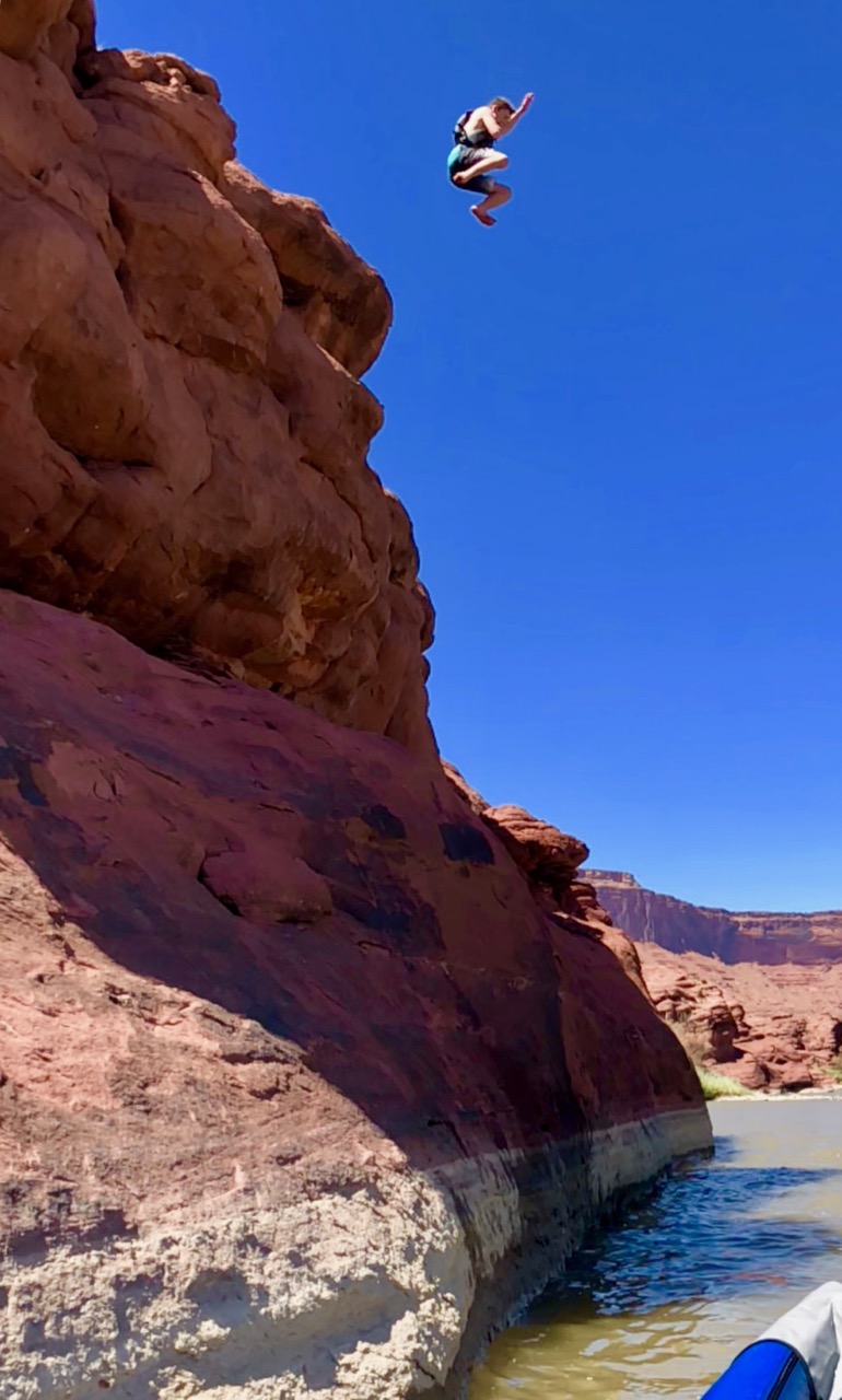
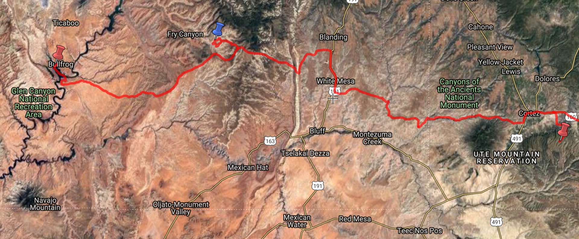
The Navy moved me all over the world when I was on Active Duty, and provided me opportunities to drive across the country solo three times when I was still in my twenties.  The first took me across the southern section to Pensacola, and was pretty much a straight (and hot) shot.  During the second, from Jacksonville to San Diego (for SERE training – ouch), I meandered a bit more and discovered my love for mountain towns.  Taos and Telluride were standouts, and I remember being just a bad decision or two away from chucking it all and going AWOL, dropping off the grid, and joining Telluride’s mountain rats for the foreseeable future.  I’m sure that would have worked out well.  The third and last was from Whidbey Island, WA to Washington DC after my first squadron tour, during which I broke my Jeep off-roading in Canyonlands, spun out on a snowy I-70 exiting the Eisenhower tunnel, and unwittingly lured a bear into my Yosemite campsite (and almost my lap) by carelessly eating salmon burgers and not properly disposing of the detritus.

I’m actually surprised at how little I remember about those trips – what I recounted above is a significant chunk of it.  One thing that did stand out from the second crossing, however, was a guided river rafting trip I took (possibly in Moab?) and the diatribe our guide delivered about Lake Powell.

Here was my view of Lake Powell:  it’s a magical place.  I had been there one time, on a houseboating trip with my family, and while I remember few day-to-day details, “otherworldly” is the overarching impression that remained.  Everything we saw and did was overwhelming and superlative.  The water was impossibly deep blue and cool, the canyons of fiery orange were everywhere you looked and went on forever, sometimes getting so narrow that you could hardly fit your boat through, only to continue winding for miles.  The surface of the water was flat and smooth, perfect for water skiing.  And solitude was simple to find, with hundreds of completely empty beaches, cliff jumping spots, or scenic anchorages to choose from.  And then after we left I learned that we had seen maybe one-twentieth of the lake, likely much less than that even.  Lake Powell is hard to get to, but it’s a true wonderland.

Here was my river guide’s view, which I had honestly never heard expressed:  It’s a crime against nature.  Bowing to political pressure, the powers that be took one of the wildest sections of one of the world’s most beautiful rivers and turned it into a reservoir, now filled with gas-guzzling noise-making boats and jet-skis, not to mention the thousands of people dropping their empty beer cans into the shallow remains of the once-deep canyons.  All of those canyons buried forever underwater.  And what’s more, he said, one day the sediment that will now collect on the bottom will get so high that the reservoir won’t work either as water storage or as recreation area any more, and we’ll be left with just a river again, but ruined as compared to its previous state.

It’s almost impossible to be unhappy while floating down a rushing river, so I think as far as I went at the time was to toss off a laughing “tell us what you REALLY think!” before negotiating the next set of rapids, but it did surprise me, and clearly it stuck with me.  I’m not a geologist so wasn’t (and am still not) in a position to evaluate his claims of what Lake Powell will someday become, though “completely filling up with sediment” seems extreme.  Again though, I filed it away.

Here are some facts about Lake Powell, some of which I found a bit surprising.  It stretches for just over 185 miles over the former Glen Canyon, almost entirely through Utah, and is formed by the Glen Canyon dam on the Colorado River.  It has about 1900 miles of shoreline.  As well as the Colorado, it’s comprised of dozens of its tributaries, all of which form sizable side canyons.  It’s the second largest reservoir in the US by maximum water holding capacity, though as of today (due to water levels) it is holding more water than Lake Mead, which is the largest.  The dam was completed in 1963, but the lake only reached full capacity in 1980.  Though the level fluctuates, it has since dropped as low as 150 feet below its full level due to drought and downstream water demands.  As a National Recreation Area, it is administered by the National Park Service.

Lake Powell

And here’s an aerial view of the Bullfrog Marina area, where we stayed.  Check out all these side canyons.

Powell close up

Now back to the present day.

I previously mentioned that we had made a few tough decisions about route planning between Colorado and Moab, and I think the fact that Father’s Day fell over the weekend in question give me a touch more pull in the deliberations, so I took the family to Lake Powell for a few days.  I had hoped to find a last-minute deal (or cancellation) on a houseboat once we got there, but spoiler alert — we didn’t.  I figured, though, that even from shore Lake Powell’s magic wouldn’t be diminished, and if nothing else we would do some daily boat / jet-ski rentals and whet our appetites for an eventual houseboating extravaganza, hopefully with extended family.  Bullfrog Marina is one of the two (and the smaller) main marina complexes on the lake.

The scenery along the route was sublime, as it is on most any drive through eastern Utah.

MV to Powell

We got inadvertently off the beaten path west of Cortez and crossed the Utah border on a lonely two-lane road with widely scattered ranches and gorgeous rock formations.  Our plan was to stop for a hike at Natural Bridges National Monument before making our way to the ferry across the lake at Hall’s Crossing.  There was a catch, though, in that the ferry runs only every two hours, and we had no idea how many cars would be attempting to make the crossing, so we didn’t want to arrive too late and risk getting stuck on the east side.  I’ve come to deeply disdain time constraints on this trip.  This instance reinforced that feeling, as Natural Bridges was worth far more time than we gave it.

IMG_0083

The girls did bag Junior Ranger badges and we were able to do something that approximated a hike, but it felt like a shortcut, and not in the good way.

Ah well, the scenery was nice.

IMG_0080

We arrived at the ferry with a good twenty minutes to spare, and discovered that we needn’t have worried about it filling up.  This is the middle of Utah, not the San Juan Islands…

IMG_0085

Our arrival at Bullfrog was inauspicious, and possibly a bit portentous.  We followed the signage to the campground, but could find no place to check in and furthermore noticed that there were no electrical / water hookups, as advertised.  This isn’t a show-stopper, but with temperatures hovering in the 90s, an a/c is pretty much mandatory in our sealed metal box, and running a generator all day to power one is not ideal.  After conferring with another arriving RV camper who looked similarly confused, I managed to find a spot with a shaky bar of 4G coverage and call the number listed on our reservation, only to be told that the RV campground was somewhere entirely different.  “Ah, great,” I thought, ”that must be where the really nice area is.”  Mmmm, no.  The RV campground, we discovered, is in the “afterthought” zone of the complex, i.e. out at the fringe of open desert, where the cell coverage went to zero and the marina’s amenities could be spotted in the distance but certainly not walked to (and not even reasonably biked to).  Power and water, yes.  But that’s it, and with a steady hot wind that made it impossible to open our awning past a few feet and unpleasant to sit outside.

IMG_0088

Still though, it’s undoubtedly pretty there, and the wind HAD to die down at some point right?  Lots of ways to make the best of this.  Plus we still had water play days in our future.  I set about managing expectations, and Tacco and I took an impromptu hike down into one of the many eerie washes, which dead-ended in a small, narrow box canyon.  It’s nice to get a little alone time with her on occasion.

The next day, Father’s Day, had been mine to plan, so I set about finding a beach from which we could base and seeing what sort of toys we could rent to have sort of a mini version of what a day houseboating would look like.

The first thing I discovered upon checking out the marina, was wow, this appears to be in poor repair.  Why had I missed this before?  Had I missed this before?  Maybe it’s a recent thing, maybe I just wasn’t old enough to pay attention, or maybe when you’re houseboating you really don’t look closely at the marina because all you want to do is leave it.  But it and the equipment there were not well maintained.  And the prices!!  Holy cow.  I guess when you’re the National Park Service’s chosen vendor and you’re in the middle of nowhere you can charge whatever you want.  But still, what they were asking, particularly for the condition of the equipment you were getting, seemed borderline immoral.

Father’s Day, though, and here we were at Lake Powell, and no way was I going to let this opportunity slide, so I sprung for a two-hour jet-ski rental and got Tacco set up at the “beach.”  Scare quotes again because… well, here it is.

IMG_0086 
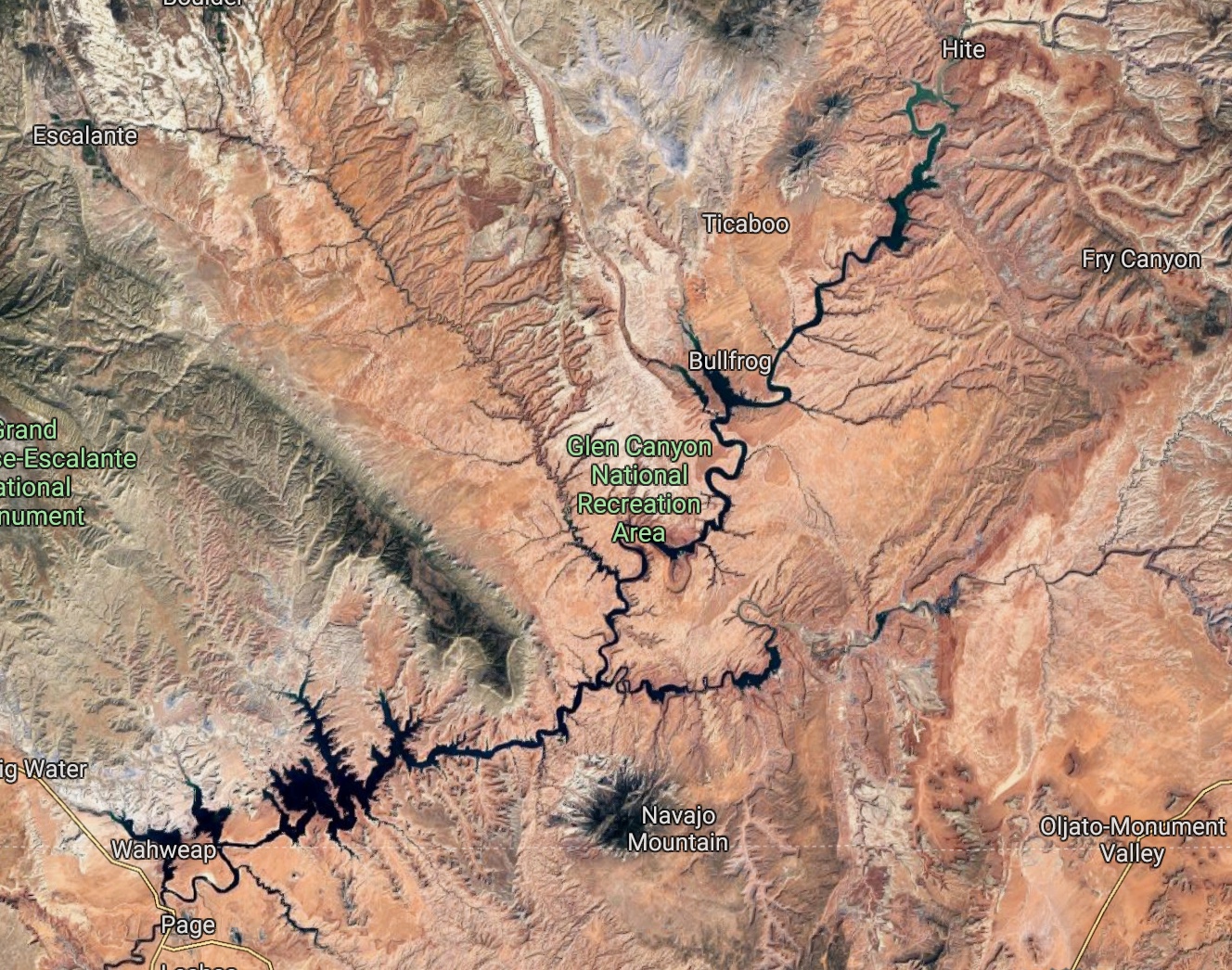
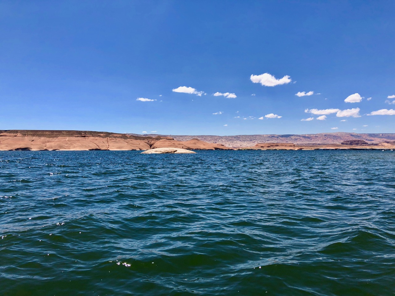
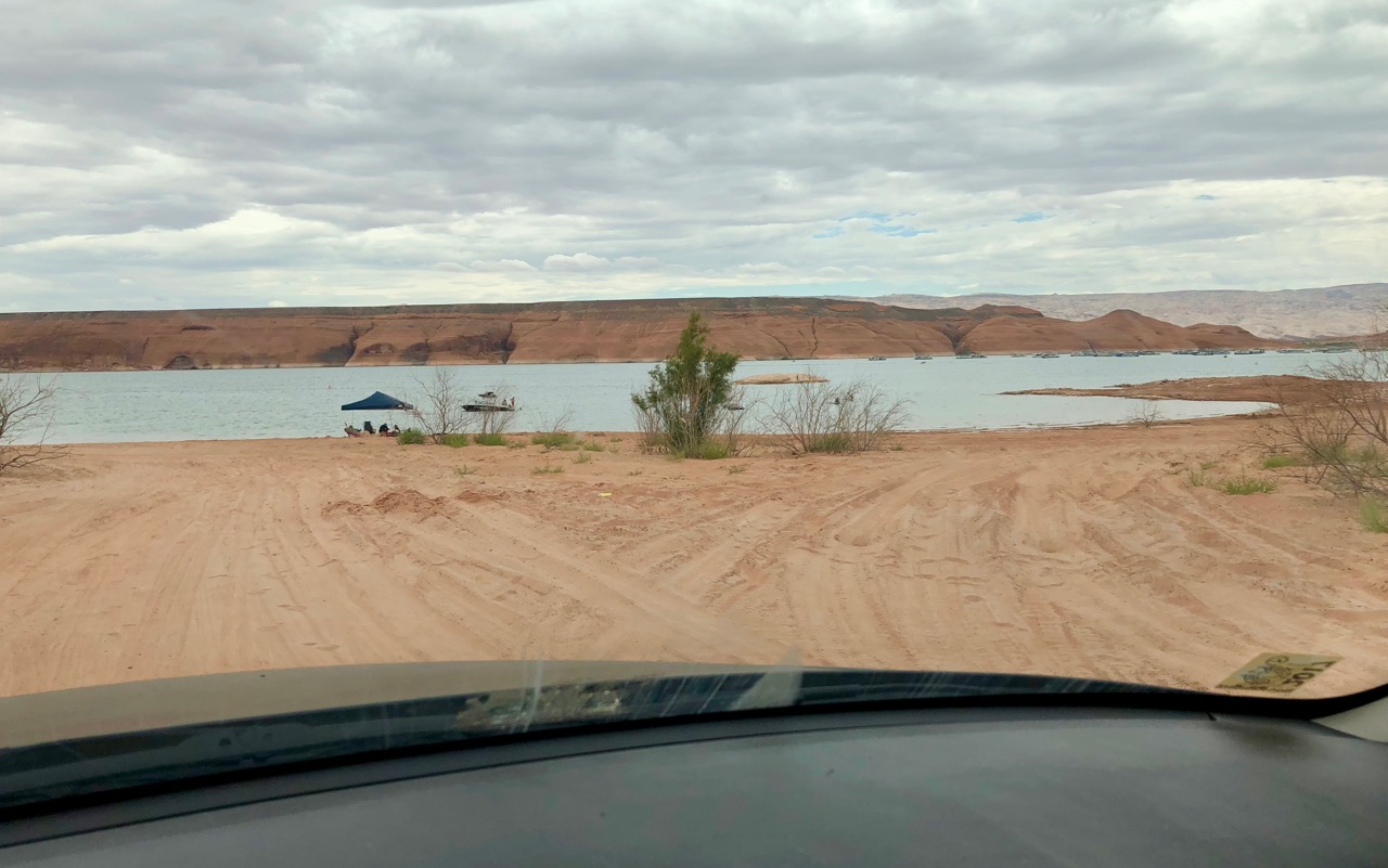
I mean, I can’t call it a bad place to be, but it’s not what I remembered from the Lake Powell of my youth.  And poor Tacco was destined to sit there under the Clam (our pop-up tent / awning) she would set up, hoping it wouldn’t get blown down by the wind, while I took one kid after the other out jet-skiing for a few hours.  God bless her, she’s a trooper and didn’t complain, though I’m pretty certain she was digging deep to find the silver lining.

Leaving Tacco and the others behind, I took Firebolt with me to pick up the jet-ski, so that we could ride together to the beach, which was a decent distance away.  After slogging through the check-out process, which the employees didn’t seem to be especially enthusiastic about, we jumped on a jet-ski and started the long, bobbing trek through the wake-free zone before we could open up the throttle and tear across to the beach where the family was waiting.  The jet-ski seemed sluggish, but I chalked that up to our having to go so slowly though the 20 minutes or so of no-wake area.  They’re designed to go fast.

Not this one, evidently.

When we finally reached the end of the long, floating jetty and I prepped Firebolt and jammed on the throttle, I was surprised to feel us lurch sluggishly forward, picking up only a knot or two and digging the nose deep into the water.  The engine was revving or at least doing its best to, but it felt like something was either diverting the flow or there was some sort of obstruction, and with the added water we’d taken on, it was difficult to remain upright.  For a moment I thought we were going to sink right then and there and have to swim over to the end of the floating jetty and wait, about a half mile off-shore, for someone with either a charitable soul or time on their hands to see us and pick us up.  I was able to get tenuous control of it, however, and turn around to head back.  No worries about “no-wake” zones this time, as we couldn’t have made a wake if we tried, but it was more than a little frustrating losing an hour and knowing that I had no way to contact Tacco to let her know what was going on.

After limping the wounded jet-ski back to the dock we finally found someone who could help us out.  This didn’t seem to be his job, so I appreciated his assistance, but it was disconcerting that he couldn’t find someone whose job it actually was, and even more so that I had to ask him to make a note on our reservation so that they could adjust our fee / times.  He assured me he would take care of it.

We finally got a good, or at least an operable jet-ski, though, and made it out to the awaiting family.  And it was fun.  Not crazy insane fun, but fun.  Hot, yes.  Windy and dusty, yeah, a bit.  But you could always get in the water.  Though the water and shoreline weren’t as clean there as my mental images of them.  I did get to take extended rides with each of the kids and do some ridiculous high-speed maneuvering, as well as some cove exploring.  I took Keeper directly across from the marina, where he jumped off and climbed a sandstone slope that was far bigger than it looked.

IMG_0101

IMG_0096

Firebolt, Woodsprite, & Tacco and I took high speed mini-trips into various little watery tendrils of lake, and several screams of delight were elicited.  At one point Keeper decided to swim out to a little island that he could claim as his own, and I subsequently ferried the girls out there to join him.

IMG_0092

IMG_0094

It was great, I can’t say it wasn’t.  Did it match up to my memories of Lake Powell though?  Not at all.  And I don’t think the seed was quite planted in Tacco or the kids either, which bummed me out a bit.  I was further brought to Earth when returning to the marina and finding that they were offering me no discount on my exorbitant rental fee after my near-sinking.  Not sure whether the employee who had helped us earlier had even informed them.  But then after my reminding them of what happened, I found myself in a “let me go back and talk to the manager” negotiation for a smaller discount, even though what I had asked for was modest.  It was a little bit disgusting, to be honest, and having no desire to waste my time haggling while the family waited at the car, I agreed to their negligible refund and left.

Our plan for the next day was to rent a ski boat and tube for the day, and attempt to salvage the lake visit with some no-kidding exploring and some on-the-water time away from the marina.  By this time I had come to the conclusion that Lake Powell is indeed amazing, but only once you get out of the marina area, so I was intent on doing so.

Well, plan foiled again when we showed up in the early morning, having spent a few hours getting everything together for the day and packing it into the car (not to mention steeling myself for the price I was about to pay and the condition of the boat I was about to rent)… “today?  Oh, I’m sorry, we’re out of boats for today.”  This after telling me yesterday that we would have no problem whatsoever getting a boat.  And no, this wasn’t the same employee with whom I had wrangled over the broken jet ski discount — they really were out of boats, or at least boats that worked.

This led rather quickly to a family pow-wow in which we discussed the merits of spending the day…well, somewhere here, we weren’t sure just where… or calling it a wash, packing up, and heading to Moab a day early.  That ended up being a pretty easy call, and once we verified that Moab had space for us, we were back to Davista to button up and bolt.

So where does that leave me with Lake Powell?

I certainly haven’t changed my position on its otherworldliness.  It’s still stunning and superlative and I want to bring the family back.  But I am firmly convinced that the less time at the marina the better.  Lake Powell’s allure lies elsewhere, and frankly the National Park Service (or in this case their proxy at the lake) is not doing a particularly diligent job.  Maybe there’s a back story, I don’t know, but given that this was just the beginning of the season I don’t think it was fatigue.  I shudder to think of what it will look like in September.

More than that, though, I found myself returning to what my surly river rafting guide had said so many years ago, and wondered what it would’ve been like to be visiting the original Glen Canyon instead of Lake Powell.  It certainly hasn’t filled in with sediment, but the level is extremely low, so low that they’ve had to cut a channel in one part of the lake in order to get houseboats away from the marina without sending them on a several mile detour.  And the mussels, I haven’t mentioned the mussels.  Way back when we first visited Grand Teton National Park last year (so long ago!) I complained about their wanting to inspect our inflatable kayaks before putting them in one of their lakes.  I now know why.  I guess the zebra and quagga mussels are invasive species that hitch rides on boats, and just take over wherever they can.  Well, in Lake Powell they have.  musselsSo much so that they seem to have given up on trying to control it, instead they just try to inspect boats to keep them from getting into other lakes in the region.  Just about every rock wall that plunges into the water was covered with them.  Billions and billions of them – unfathomably many.  It seems so odd to see mussels on the rocks in the middle of the desert.  And here are these government run marinas inefficiently and expensively funneling partiers into the once-pristine lake that was a once-even-more-pristine canyon with a rushing river at the bottom.  It’s a little depressing.

So… maybe he had a point.

Jury is still out for me.  And I certainly want to return still to see if I can recapture the magic with my family.  But it did make me think.

IMG_0090

Cozy Cliffsides and Brilliant Corners

We rounded out our ancient Native American dwelling theme with a relatively short visit to Mesa Verde National Park, which sits just southeast of Cortez, CO in the Four Corners region of the country.  For a relatively open and unpopulated area, Four Corners has a lot going on, scenery and heritage-wise.  Utah and Arizona share Monument Valley, which anyone who grew up on Roadrunner / Wile E Coyote cartoons would recognize immediately.  New Mexico has Shiprock, which is of course a monadnock, a word I learned two minutes ago.  And Colorado has EVERYTHING ELSE – Mesa Verde, Canyon of the Ancients, the San Juan mountains, Telluride, Durango, Ouray, and probably a few dozen more amazing places I don’t even know about yet.

4C

Mesa Verde had been a “can’t miss” National Park since our early planning stages, but I have to admit that I wasn’t certain what to expect, other than cliff dwellings, of which I’d seen several pictures.  (This one’s mine)

IMG_0065

A few things surprised me about Mesa Verde.  One was the number of dwellings, which they call “houses,” each of which housed multiple families.  I had imagined there being only one large complex of dwellings, but there are in fact many of them carved into the sandstone cliffsides.  Another was the fact that they’re designed to be climbed down into rather than up to.  The majority of the residents’ farming, hunting, etc was performed on the high mesa above the cliffs, which, due to topography and micro-climactic factors, was quite fertile considering its elevation and relative dryness.  Envisioning the logistics of getting the spoils of a hunt to the family by climbing down the cliff via the tiny footholds in the sandstone was mind-bending.

IMG_0072

As we only had one full day to explore the park, we arose early and headed straight for the ranger station.  Guided tours are the only way to see the most popular “houses,” and they’re number-limited, so it’s good that we arrived early.  We had a choice of several, and opted to tour Balcony House after getting buy-in from the kids.  The Balcony House tour is billed as the most challenging one due to several exposed ladder climbs and a tiny passageway through which everyone needs to crawl in order to exit the site.

The girls grabbed their Junior Ranger booklets once again and got to work.

IMG_0043

Here once again I’ll defer to the pictures to tell the story, as Balcony House truly was an extraordinary site.

IMG_0051

IMG_0050

IMG_0052

The kids tackled the challenging terrain without hesitation, which was far from a given, and we were thrilled to see them pushing themselves a bit.

IMG_0064

IMG_0061

IMG_0058

One other surprise, about which we learned during the tour, was the relatively short time frame in which the cliff dwellings were actually inhabited.  They look so intricate and painstakingly crafted, yet they were abandoned after only a few generations.  The exhibits within the ranger station mentioned drought as a likely reason for them moving on, but I had to wonder whether the high degree of difficulty in reaching them played any role.  As a parent of young kids, it’s hard not to view something like that through the lens of potential catastrophic accidents.

IMG_0056

Here’s that tiny passageway we had to crawl through.  I don’t mind tight spaces, so didn’t find it nerve-wracking, but I can certainly imagine how someone might.  It stayed that height and width for a good twenty yards; turning around would’ve been pretty much impossible for all but the smallest people.

IMG_0060

All in all, Mesa Verde more than lived up to its “can’t miss” status and cemented my appreciation for this region of the country.

IMG_0068

IMG_0075

Next up is Lake Powell, which I’ve been looking forward to introducing the family to for quite some time.  Lots of water play in our very near future!

Animas

“Anima” is a cool word.  Depending on the context and the language, it means “soul” or “spirit” or “psyche.”  Jung had a sub-theory of the subconscious involving the anima and the animus.  A friend of mine had it tattooed to her ankle back in the day when pretty much only bikers got tattoos, which is also pretty cool, I think.

That makes Animas a pretty great name for a river in my world.  And as it turns out, the Animas runs through Durango, which is one of the coolest towns in one of our coolest states.  That’s a whole lot of cool.

You know what isn’t cool though?  Fire.  And when we got there, Durango, or at least the northern portion thereof (and quite a bit of forest beyond it), was literally on fire.  This became a major factor in route planning, as we had a good bit of flexibility – basically we were looking at taking a week to get from Albuquerque to Moab, which isn’t very far, but spans a lot of spectacular terrain.  Many options, with some difficult choices we had to make.  We already knew we wanted to spend some time in Durango, but thereafter we had wanted to take the Million Dollar Highway, which is another name for Colorado Route 550 between Silverton (just north of Durango) and Ouray, a tiny and preposterously pretty ex-mining town surrounded by jagged peaks.  Upon our arrival we discovered that the Million Dollar Highway was at least partially engulfed in flames, and of course closed.  Well, shoot.

to Durango

There was a up side, though, in that the closure facilitated a visit to Mesa Verde National Park (next post), which dovetailed nicely in theme with Tacco & the kids’ visit a few days ago to Bandelier National Monument and our visit along the way to Durango to Aztec Ruins NM.  Aztec is a fairly small site, but interesting, and as a bonus we got to see a bunch of bats hanging from the ceiling of one of the dwellings.

IMG_0019IMG_0021

I think fire and the attendant blanket of smoke are probably the only things that could make Durango less appealing as a place to be (or live – if it were more easy to fly out of, it would almost certainly have made our short list of potential places to settle).  It sits right on the border of high desert and mountain biomes, with amazing weather, the Animas flowing through town, mountain biking galore, and Colorado Rockies skiing nearby.  In some ways it reminds me of Bend, but smaller and with more extreme terrain.  It’s an extraordinary place.

But that smoke…  We arrived in the early afternoon to find it hazy, but not too bad smoke-wise, despite the edges of the fire being just a few miles to the north.  Unfortunately we were informed by the campground personnel that the prevailing winds made it such that while afternoons weren’t bad, each morning brought very heavy smoke into town, so much so that even going outside wasn’t recommended.  They were correct, as we discovered the next day.  It was bad.  Bad enough that we didn’t particularly want to leave the confines of the motorhome and bad enough that the routine but sorely needed maintenance we had painstakingly scheduled for Davista had to be cancelled due to the mechanics not being willing to open their garage door to let the smoke in.

Here’s how it looked in the morning.

IMG_0027

Luckily the prevailing wind pattern, um… prevailed, and that provided for clearing in the afternoons as the wind direction shifted to the south, blowing the smoke out of town each day.  I’m not sure why it took us this long trip-wise, but we finally pulled the soccer ball out of its storage compartment and ran down to the campground’s large, grassy field to play a makeshift game of two-on-two.  The kids loved it and wanted to continue until after dark.  Anything that gets them out of their stare-at-a-screen pattern I’m all for, but once it got too dark to see, the running around in a field with potential ankle-twisting divots caused me to bow out.  Checking out the glow of the fire and watching the various flame jumper aircraft flying in to drop their loads of fire-retardant was an equally entertaining alternative.

IMG_0026

On our second to last day, we were able both to reschedule our sorely needed Davista maintenance and to raft the Animas.  Though I would have preferred to run it in our own kayaks, we’re not quite there yet, and opted to go with a guide.  Great call I think, as the girls still need some time to adapt to rapids, particularly given our upcoming rafting trip in Moab.  They both (Firebolt especially) have a tendency to chicken out of unfamiliar experiences if they perceive potential danger, and once the heels are dug in it’s pretty much game over, at least for that day.  So this was a good warmup.  Granted, they had already floated the Meramec, but this was definitely a few steps up from that, and the Colorado near Moab would likely be a couple more.  And of course there’s the end game of living on/near the Deschutes – it would thrill me to have a household full of river rats.

I didn’t manage to get any pictures unfortunately, but they loved it, including the decent set of rapids at the end.  Any river float is going to be a highlight for me; it was especially encouraging, though, to see the kids coming around to my point of view.

We do have one more stop in southwestern Colorado, for which I’m grateful, but overall I wish we had more time to spend here.  There’s so much to see and do, a good bit of which we’re missing – we had to bypass Telluride and the Black Canyon of the Gunnison – and what we did see was limited by the fires.  That’s a recurring theme during this journey of course — wishing we had more time.  But then I guess it always is.

Los Pollos (y Las Cabras) Hermanos

IMG_0013

IMG_0001

Colorado’s neighbor to the south, though the two states share parts of the same mountain range, is a very different place.  In fact, after a few days in New Mexico my overarching impression was that it is the state least like any other in the country, including Alaska and Hawaii.  There really is a feeling there of being elsewhere – maybe not quite another country, but very close to it.

First of all there’s the elevation, at least in the northern part of the state.  While that’s not unique in itself, there’s not much around to give you the impression that you’re high up.  There are peaks scattered about, but also quite a bit of expansive, mostly arid flatland.  It was surprising to be making our way across a massive plain and to check my phone’s compass app (which has an altimeter) and discover that we were at 8000’.  And then there’s the architecture, which seems to center on pueblos and adobe, and is just about everywhere.  The signage is notably different as well, with everything written in both Spanish and English.  I could go on – the food (“which do you want, red chili, green chili, or Christmas?”), the look of the towns, the place names – but really it boiled down to a vibe that I didn’t entirely catch onto until we had been there for a week or so.

One of Tacco’s dearest friends, with whom she’s been very close since childhood, lives in Corrales, which hugs the Rio Grande just north of Albuquerque, so this was a visit we had all looked forward to for quite some time.

IMG_1532

We parked Davista at a City RV park in Bernalillo, a bit further north, and I have to say, I wasn’t overly thrilled to be leaving the family there for my trip – it was good to know that they would be spending most of their time with friends, rather than at Davista.  Don’t get me wrong, it wasn’t full of fallen chemistry teachers cooking meth (and incidentally we somehow managed to go our entire time in Albuquerque without seeing any Breaking Bad points of interest, despite being fans), it was just a touch run down and didn’t seem to be attracting the segment of the public we were used to seeing while traveling.

Another thing – it’s getting hot.  Unsurprising given that it’s June and we’re in the desert southwest, but still.  Davista’s a/c can only work so hard, particularly when there’s no humidity in the air.  And we still have Lake Powell and Moab to go.

Fortunately Tacco’s friend lives in the bosque, which constitutes the majority of Corrales.  Don’t know what that is?  Neither did I.  Once again, here’s Wikipedia to the rescue:

“In the predominantly arid or semi-arid southwestern United States, a bosque is an oasis-like ribbon of green vegetation, often canopied, that only exists near rivers, streams, or other water courses. The most notable bosque is the 300-mile (480 km)-long ecosystem along the middle Rio Grande in New Mexico that extends from Santa Fe south to El Paso, Texas.”

Pretty cool.  Shady too.

Corrales is another unique place in that it’s retained a very rural character without being sprawling farmland.  Lots of dirt roads and animals everywhere (including on many of the properties), yet if you were to drive down the main drag it looks like a quaint suburb, or at least the New Mexican version of one.  Her sister + family live nearby and have some horses, and she has chickens, alpacas, and goats (possibly more?) at a friend’s property.  This was thrilling for the kids, and a definite highlight.  Just about anyone will be melted by holding a baby goat, even a video-game enthusiast pre-teen.

IMG_0004

IMG_0008

This one is Tulip, I believe.

IMG_0010

The girls got to collect the chickens’ fresh eggs and pet the alpacas.

IMG_0014

IMG_0002

I left for my trip the day after we arrived there, but was treated to many, many pics of the kids playing with the animals sent via text.

Upon my return, I accepted Tacco’s friend’s gracious offer to give me a treatment for my sciatica.  She runs an eastern medicine clinic as a practitioner, and uses various modalities, including acupuncture.  It was actually somewhat of a joint treatment, as Tacco stayed in the room as well and assisted.  I won’t lie, I was a bit nervous about it, as I haven’t always had the best experiences with acupuncture.  I do enjoy letting Tacco treat me when I have something ailing me, but in general acupuncture can feel intrusive to me.  The best way I’ve found to describe it is that it, at times, feels like something is being touched that isn’t supposed to be touched.  And then a few times – not often, but enough to lodge in my memory – it has been downright painful.  Not poking-needle painful, but deeply, profoundly painful.   And this treatment, I was informed, would likely involve both “e-stim” (basically running electric current through some of the needles) and the “really long needles” in order to reach deeper portions of my glutes, which they thought might be inflaming my sciatic nerve.  None of that sounded amusing.  On the other hand, at this point I’ll try most anything, as spending each day in pain is taking a toll on me.  The needles couldn’t possibly hurt worse than the sciatica.

As it turned out, it was a very productive treatment, at least I think it was.  And she pulled out all the stops – the big needles, the cups (I won’t go far into this, but it’s essentially a massage in reverse in that heat is used to create suction in the cups, which are applied to the body and used to pull fascia / tissue up and away, rather than being pushed down as in a massage), the electricity, everything.  It was uncomfortable, and I’m glad I didn’t see the actual needles, as I was told they were several inches deep into my buttocks.  The sensation wasn’t so much of a needle being inserted, but I definitely felt it when she reached the level of tissue/muscle she was after.  Yow.  And then the e-stim made the muscles there twitch uncontrollably.  It’s exactly what she was going for, so I’m hopeful for an improvement.  But right now it’s all pretty sore down there, likely due to some muscles being aggressively woken up and/or loosened up after being in a state they shouldn’t have been in for a long time.

On our evening we were invited to a BBQ / hangout at her sister’s house, which is gorgeous and has a pool.  It was a perfect opportunity to lounge around and enjoy the company.

IMG_0016

Alas no river kayaking after all due to a long-running drought in the area – the Rio Grande is just a trickle.  But that’s OK, as we have some serious rafting planned for our Moab visit.  I’ll tackle river kayaking when we get to Bend.